Canada Topographic Maps

Nash Creek Topo Map

Free Topo Maps Downloadable Online: 106D

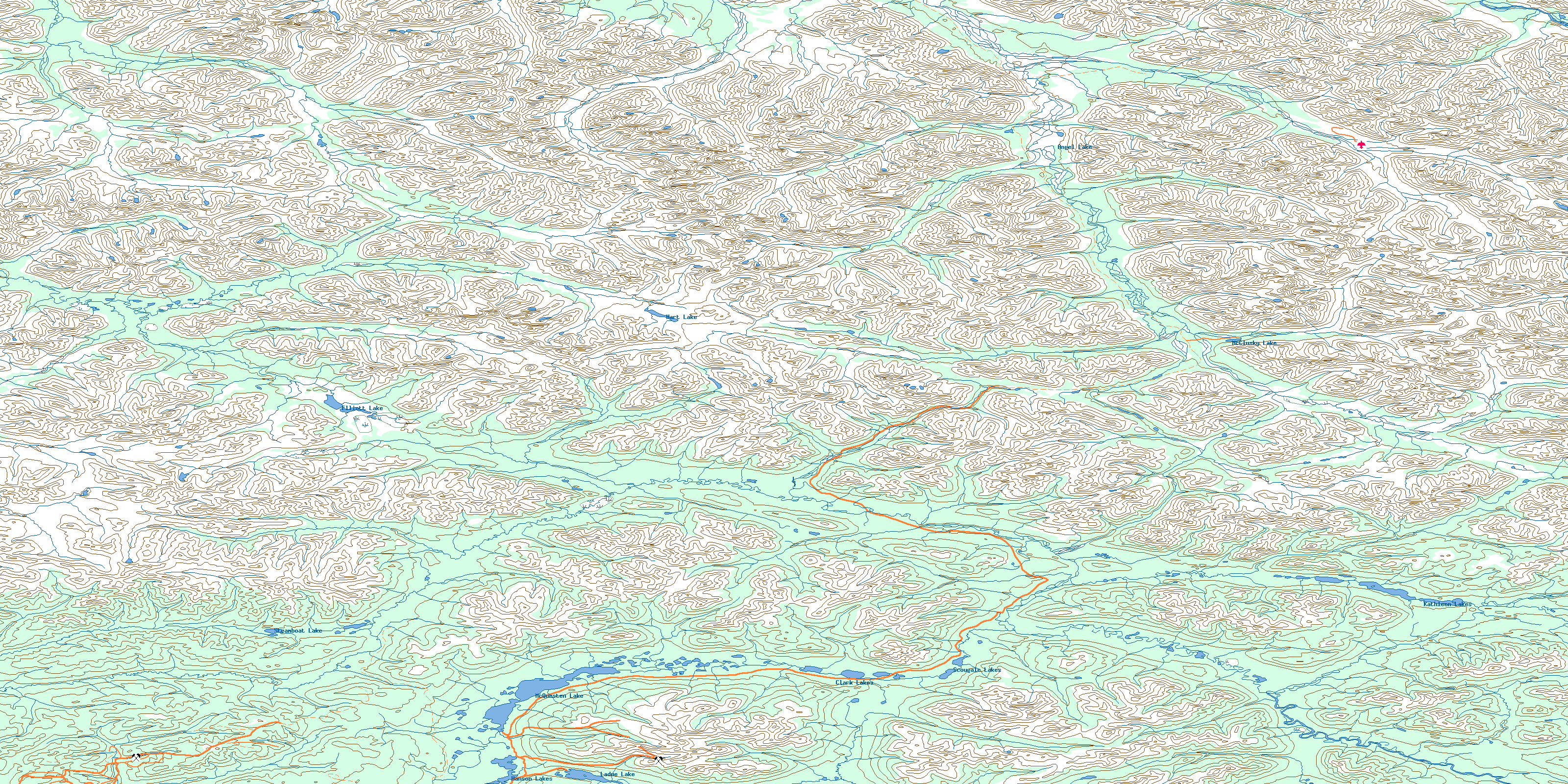
106D Nash Creek Topo Map

To view this map, mouse over the map preview on the right.

You can also download this topo map for free:
106D Nash Creek high-resolution topo map image.

Maps for the Nash Creek map sheet 106D at 1:250,000 scale are also available in these 4 versions:

  1. Buy Digital Topo Maps on Data-DVD
  2. Buy 106D Nash Creek Waterproof Topographic Map
  3. Buy 106D Nash Creek Topographic Paper Map
  4. Free Printable NTS Topographic Map
 

Nash Creek Surrounding Area Topos (NTS 106)

106M Fort Mcpherson Free Online Topo Map Thumbnail 106N Arctic Red River Free Online Topo Map Thumbnail 106O Travaillant Lake Free Online Topo Map Thumbnail 106P Canot Lake Free Online Topo Map Thumbnail
106L Trail River Free Online Topo Map Thumbnail 106K Martin House Free Online Topo Map Thumbnail 106J Ontaratue River Free Online Topo Map Thumbnail 106I Fort Good Hope Free Online Topo Map Thumbnail
106E Wind River Free Online Topo Map Thumbnail 106F Snake River Free Online Topo Map Thumbnail 106G Ramparts River Free Online Topo Map Thumbnail 106H Sans Sault Rapids Free Online Topo Map Thumbnail
106D Nash Creek Free Online Topo Map Thumbnail 106C Nadaleen River Free Online Topo Map Thumbnail 106B Bonnet Plume Lake Free Online Topo Map Thumbnail 106A Mount Eduni Free Online Topo Map Thumbnail
© Department of Natural Resources Canada. All rights reserved.

106D Nash Creek Area Topo Maps at 1:50,000

106D13 No Title Topo Map Thumbnail 106D14 Louis Creek Topo Map Thumbnail 106D15 Bear River Topo Map Thumbnail 106D16 Slats Creek Topo Map Thumbnail
106D12 Elliott Creek Topo Map Thumbnail 106D11 Hart Lake Topo Map Thumbnail 106D10 Bond Creek Topo Map Thumbnail 106D09 Mcclusky Lake Topo Map Thumbnail
106D05 Elliott Lake Topo Map Thumbnail 106D06 Horseshoe Hill Topo Map Thumbnail 106D07 Williams Creek Topo Map Thumbnail 106D08 No Title Topo Map Thumbnail
106D04 Dublin Gulch Topo Map Thumbnail 106D03 Mcquesten Lake Topo Map Thumbnail 106D02 Scougale Creek Topo Map Thumbnail 106D01 Mount Westman Topo Map Thumbnail
© Department of Natural Resources Canada. All rights reserved.
Nash Creek Topo Map 106D at 1:250,000 Scale
© Department of Natural Resources Canada. All rights reserved.
 
Buy Topographic Maps DVD
Newsletter Sign-up

Yes, I want to receive map store discounts.


Bookmark and Share