Free Ellef Ringnes Island Topographic Map
Topo maps you can print: 069F Ellef Ringnes Island
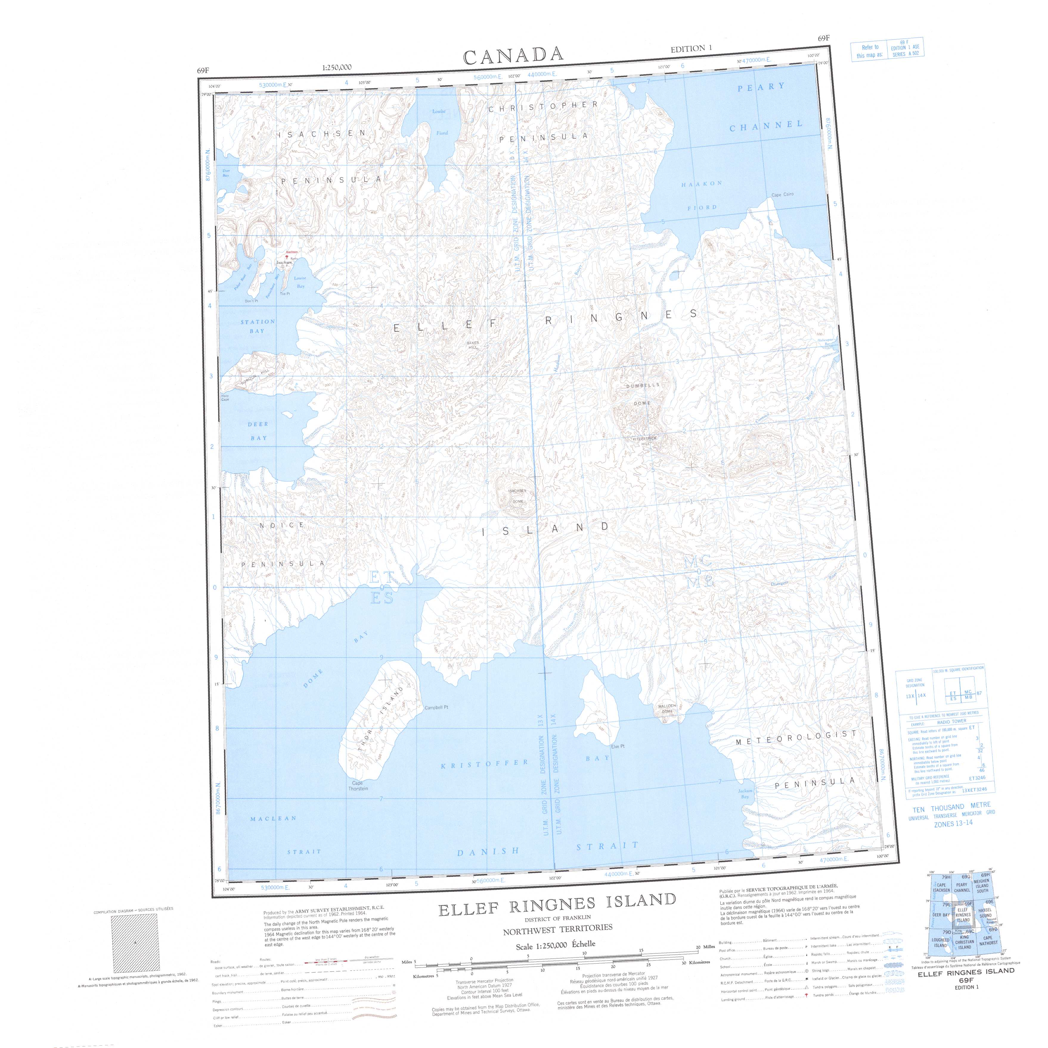
069F Ellef Ringnes Island Topo Map
To view this map, mouse over the map preview on the right.
You can also download and print this topo map for free:
069F Ellef Ringnes Island low-resolution printable topographic map.
A high-resolution map of Ellef Ringnes Island is available on Data-DVD.
Maps for the Ellef Ringnes Island map sheet 069F at 1:250,000 scale are also available in these 4 versions:
Ellef Ringnes Island Surrounding Area Topographic Maps at 1:250,000 scale (NTS 069)
 |
 |
 |
 |
 |
 |
 |
 |
© Department of Natural Resources Canada. All rights reserved.
Ellef Ringnes Island Topo Maps at 1:50,000 (NTS 069F)
 |
 |
 |
 |
 |
 |
 |
 |
 |
 |
 |
 |
 |
 |
 |
 |
© Department of Natural Resources Canada. All rights reserved.
© Department of Natural Resources Canada. All rights reserved.
069F Related Maps:
069F Ellef Ringnes Island069F01 Jackson Bay
069F02 Elve Point
069F03 Campbell Point
069F04 Cape Thorstein
069F05 Dome Bay
069F06 Isachsen Dome
069F07 Transection River
069F08 Divergent River
069F09 Contour River
069F10 Dumbbells Dome
069F11 Baker Hill
069F12 Station Bay
069F13 Isachsen
069F14 Louise Fiord
069F15 Haakon Fiord
069F16 Cape Cairo
