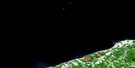
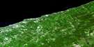
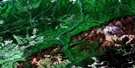
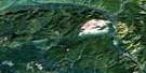
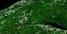
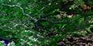
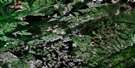
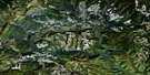
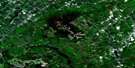
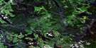
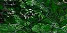
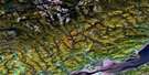
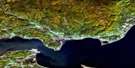
St-Jean-Baptiste-Vianney Satellite Image Map
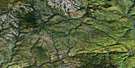
Download Free Aerial Photo 022B11 at 1:50,000 scale
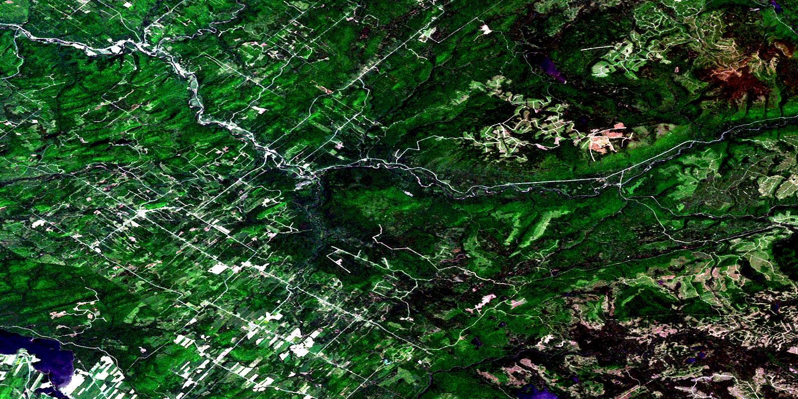
St-Jean-Baptiste-Vianney Satellite Imagery
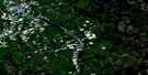
To view this satellite map, mouse over the air photo on the right.
You can also download this satellite image map for free:
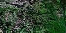
022B11 St-Jean-Baptiste-Vianney high-resolution satellite image map.
Maps for the St-Jean-Baptiste-Vianney aerial map sheet 022B11 at 1:50,000 scale are also available in these versions:
St-Jean-Baptiste-Vianney Surrounding Area Aerial Photo Maps
 |
 |
 |
 |
 |
 |
 |
 |
 |
 |
 |
 |
 |
 |
 |
 |
© Department of Natural Resources Canada. All rights reserved.
St-Jean-Baptiste-Vianney Gazetteer
The following places can be found on satellite image map 022B11 St-Jean-Baptiste-Vianney:
St-Jean-Baptiste-Vianney Satellite Image: Bays
Anse des BeaulieuBaie à Gérard
St-Jean-Baptiste-Vianney Satellite Image: Beaches
Plage de la Grande FrayeSt-Jean-Baptiste-Vianney Satellite Image: Miscellaneous campsites
Camp Sable-ChaudSt-Jean-Baptiste-Vianney Satellite Image: Capes
La Langue de TerreLa Presqu'île
Pointe à Bouleau
Pointe à Jean-Thomas
Pointe à Tremblay
Pointe du Docteur-Boudreau
Pointe Fine
St-Jean-Baptiste-Vianney Satellite Image: Channels
La PasseSt-Jean-Baptiste-Vianney Satellite Image: City
AmquiSt-Jean-Baptiste-Vianney Satellite Image: Geographical areas
BlaisCasault
Cuoq
La Grange
Lagrange
Langis
Le Clercq
Leclercq
Lepage
Matane
Saint-Denis
Saint-Jean-Baptiste-Vianney
Saint-René-de-Matane
Saint-René-Goupil
Saint-Tharcisius
Saint-Vianney
Seigneurie du Lac-Matapédia
Tessier
St-Jean-Baptiste-Vianney Satellite Image: Hydraulic construction
Barrage CasaultBarrage du Lac-Duvivier
St-Jean-Baptiste-Vianney Satellite Image: Islands
Cap à GouletÎle Ronde
Le Monticule
St-Jean-Baptiste-Vianney Satellite Image: Lakes
Étangs à RicardÉtangs Cajetan
Étangs de la Sableuse
Grand lac Petchedetz
Lac à Euclide
Lac à Jean
Lac à la Loutre
Lac à Simoneau
Lac Amélie
Lac Bergeron
Lac Boucane
Lac Bourg
Lac Cajetan
Lac Casault
Lac Cuoq
Lac D
Lac de la Grande Ligne
Lac des Champlain
Lac des Coeurs
Lac du Brûlé
Lac du Français
Lac du Milieu
Lac du Nord
Lac du Poisson Blanc
Lac Duvivier
Lac en Tourbe
Lac Fournier
Lac Frenette
Lac Gigon
Lac Hébert
Lac Henri
Lac John
Lac Johnson
Lac Lafontaine
Lac Lafontaine
Lac Langis
Lac Lavoie
Lac Le Clercq
Lac Lee
Lac Lee
Lac Martel
Lac Matapédia
Lac Mius
Lac Pechedeck
Lac Pelletier
Lac Petchedec
Lac Petchedetz
Lac Pinault
Lac Pourri
Lac Tombereau
Lac Towagodi
Lac Tremblay
Lac Vert
Lac Vert
Lac Vidrien
Lacs Chandler
Lacs Gunn
Lacs Langis
Lacs Tamagodi
Lacs Towagodi
Lacs Towagodi
Petit lac Émélie
Petit lac Hébert
Petit lac Pechedeck
St-Jean-Baptiste-Vianney Satellite Image: Marine navigation features
La PelleSt-Jean-Baptiste-Vianney Satellite Image: Mountains
Colline de la TortueMont à Barbeau
Mont aux Perches
Mont Charles-E.-Vézina
Mont de l'Ouest
Mont Langis
Mont Petchedetz
Mont William-Price
Montagne à Beaupré
Montagne à Valcourt
Montagne de la Tour
Montagne de la Tour
Monts Chic-Chocs
Monts Shickshock
St-Jean-Baptiste-Vianney Satellite Image: Other municipal/district area - miscellaneous
Lac-CasaultLac-Matapédia
St-Jean-Baptiste-Vianney Satellite Image: Conservation areas
Réserve faunique de la Rivière-MataneRéserve faunique de Matane
Zec Casault
Zec de la Rivière-Matane
St-Jean-Baptiste-Vianney Satellite Image: Natural resources sites
Mine de SiliceSt-Jean-Baptiste-Vianney Satellite Image: Rivers
Branche du Ruisseau JohnCours d'eau Arthur-Ross
Cours d'eau Bérubé
Cours d'eau Bérubé
Cours d'eau Côté
Cours d'eau de la Fabrique
Cours d'eau Deshaies
Cours d'eau Lavoie
Cours d'eau N.-Lévesque
Cours d'eau Perron
Cours d'eau Turcotte
Le Grand Ruisseau
Le Gros Ruisseau
Petit ruisseau Tamagodi
Petite rivière Langis
Petite rivière Matane
Rivière à la Truite
Rivière Casault
Rivière Causapscal
Rivière Causapscal Est
Rivière Causapscal Sud
Rivière Duvivier
Rivière Inconnue
Rivière Langis
Rivière Matane
Rivière Matane
Rivière Matane Nord-Est
Rivière Matapédia
Rivière Pechedeck
Rivière Petchedec
Rivière Sableuse
Rivière Tamagodi
Rivière Tobégote
Rivière Towagodi
Ruisseau à Jack
Ruisseau à la Carpe
Ruisseau Amélie
Ruisseau Bastien
Ruisseau Cajetan
Ruisseau Chandler
Ruisseau Chandler Ouest
Ruisseau Croche
Ruisseau Cuoq
Ruisseau de la Beurrerie
Ruisseau de la Chantepleure
Ruisseau de la Fabrique
Ruisseau de la Mine
Ruisseau de l'Ouest
Ruisseau des Gagnon
Ruisseau des Pitounes
Ruisseau du Grand Frai
Ruisseau du Lac Lee
Ruisseau du Nord
Ruisseau du Populetum
Ruisseau Duval
Ruisseau Ferré
Ruisseau Firmin
Ruisseau Fournier
Ruisseau Gagnon
Ruisseau Gaudreau
Ruisseau Gunn
Ruisseau Inconnu
Ruisseau Jean
Ruisseau John
Ruisseau Johnson
Ruisseau Kenny
Ruisseau Lavoie
Ruisseau Lee
Ruisseau Lemieux
Ruisseau Lepage
Ruisseau Martel
Ruisseau Martel
Ruisseau Michaud
Ruisseau Morneau
Ruisseau Pearson
Ruisseau Pelletier
Ruisseau Pénomect
Ruisseau Perron
Ruisseau Pinault
Ruisseau Polyte
Ruisseau Poulin
Ruisseau Sableux
Ruisseau Saint-Jean
Ruisseau Simoneau
Ruisseau Sipujij
Ruisseau St. Lawrence
Ruisseau Tremblay
St-Jean-Baptiste-Vianney Satellite Image: River features
Fosse AntonioFosse aux Caprices
Fosse Cuoq
Fosse de la Grande Batture
Fosse des Piliers
Fosse Gagnon
Fosse Gaudreau
Fosse John
Fosse Johnson
Fosse Lebreux
Fosse Marilyn
Fosse Pénomect
Fosse Simoneau
La Bécateron
La Boucanerie
La Cachée
La Cage
La Clôture Blanche
La Côte à Tuer
La Côte aux Perches
La Côte de Glace
La Coulée des Bassins
La Coulée des Frissons
La Coulée des Seaux
La Falaise
La Fosse Rouge
La Fumeuse
La Grande Batture
La Grande Faille
La Petite Matane
La Plus Lente
La Pourquoi-Pas
La Sauteuse
La Snell
La Surprise
La Tour
La Truite
La Vieille
Le Bassin
Le Billot
Le Cap Seize
Le Castor
Le Chenail
Le Chevreuil
Le Cran Noir
Le Cran Rouge
Le Four
Le Grand Frai
Le Grand Tamagodi
Le Gros Petchedec
Le Gros Petchedetz
Le Lot Inculte
Le Moulin
Le Panier
Le Petit Rapide
Le Petit Tamagodi
Le Phénomène
Le Pont d'Amqui
Le Quai de Bois
Le Quai de Pierres
Le Repos
Le Ruisseau Gagnon
Le Silice
Le Tuyau
Le Vieux Tentage
Le Vison
Le Vivier
L'Écureuil
Les Aulnes
Les Bouleaux
Les Cèdres
Les Chenaux
Les Merisiers
Les Mouches
Les Peupliers
Les Piliers
Les Roches
Les Tufs
L'Île
L'Orignal
L'Ours
St-Jean-Baptiste-Vianney Satellite Image: Road features
Côte à BouleauCôte à Débert
Côte à Goulet
Côte aux Perches
Côte de Glace
Côte de Glaise
Côte de la Boucanerie
Côte des Boeufs
Côte du Bonhomme-Georges
Côte du Mille
Côte du Pont-Blanc
Côte du Vingt-et-Un
Ponceau Deshaies
Ponceau Duval
Pont à la Truite
Pont Angers
Pont Blanc
Pont Caouette
Pont Chassé
Pont de la Beurrerie
Pont de la Coulée
Pont de la Coulée-Carrier
Pont de l'Inconnue
Pont du Camp-Deux
Pont du Chandler-Ouest
Pont du Ferré
Pont du Ruisseau-Gagnon
Pont du Ruisseau-Johnson
Pont Fournier
Pont François-Gagnon
Pont Jean-Chassé
Pont Jos-Jean
Pont Martel
Pont Pearson
Pont Petchedetz
Pont Pierre-Rioux
Pont Rémillard
Pont Towagodi
St-Jean-Baptiste-Vianney Satellite Image: Towns
Val-BrillantSt-Jean-Baptiste-Vianney Satellite Image: Unincorporated areas
Baie-Saint-LaurentGoupil
La Baie-des-Frissons
La Coulée
La Ferme-Jeunesse
La John
La Renversée
La Vérendrye
Lac-Pinault
Lac-Towagodi
Le Dépôt-Soucy
Le Renversé
Le Sept-de-la-Tour
Poste-Canton-Blais
Poste-John
Rivière-Matane
Ruisseau-Gagnon
Saint-Nil
Saint-René-de-Matane
Saint-Tharcisius
Saint-Vianney
St. Lawrence
Village-à-Dancause
Village-Beaudoin
St-Jean-Baptiste-Vianney Satellite Image: Valleys
Coulée CarrierVallée de la Rivière Matane
St-Jean-Baptiste-Vianney Satellite Image: Villages
Saint-Alexandre-des-LacsSaint-Benoît-Joseph-Labre
Sainte-Paule
Saint-Jean-Baptiste-Vianney
Saint-Nil
Saint-Pierre-du-Lac
Saint-René-de-Matane
Saint-Tharcisius
Saint-Tharsicius
Saint-Vianney
Val-Brillant
© Department of Natural Resources Canada. All rights reserved.
022B Related Maps:
022B Matane022B01 Escuminac
022B02 Oak-Bay
022B03 Milnikek
022B04 Lac Des Chasseurs
022B05 Lac-Humqui
022B06 Causapscal
022B07 Ruisseau Jerome
022B08 Riviere Angers
022B09 Monts Berry
022B10 Riviere Bonjour
022B11 St-Jean-Baptiste-Vianney
022B12 Sayabec
022B13 Matane
022B14 Ste-Felicite
022B15 Mont Logan
022B16 Mont Albert
