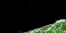
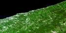
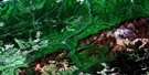
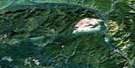
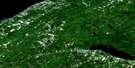
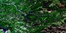
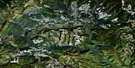
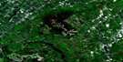
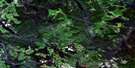
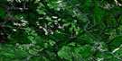
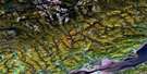
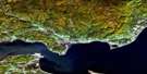
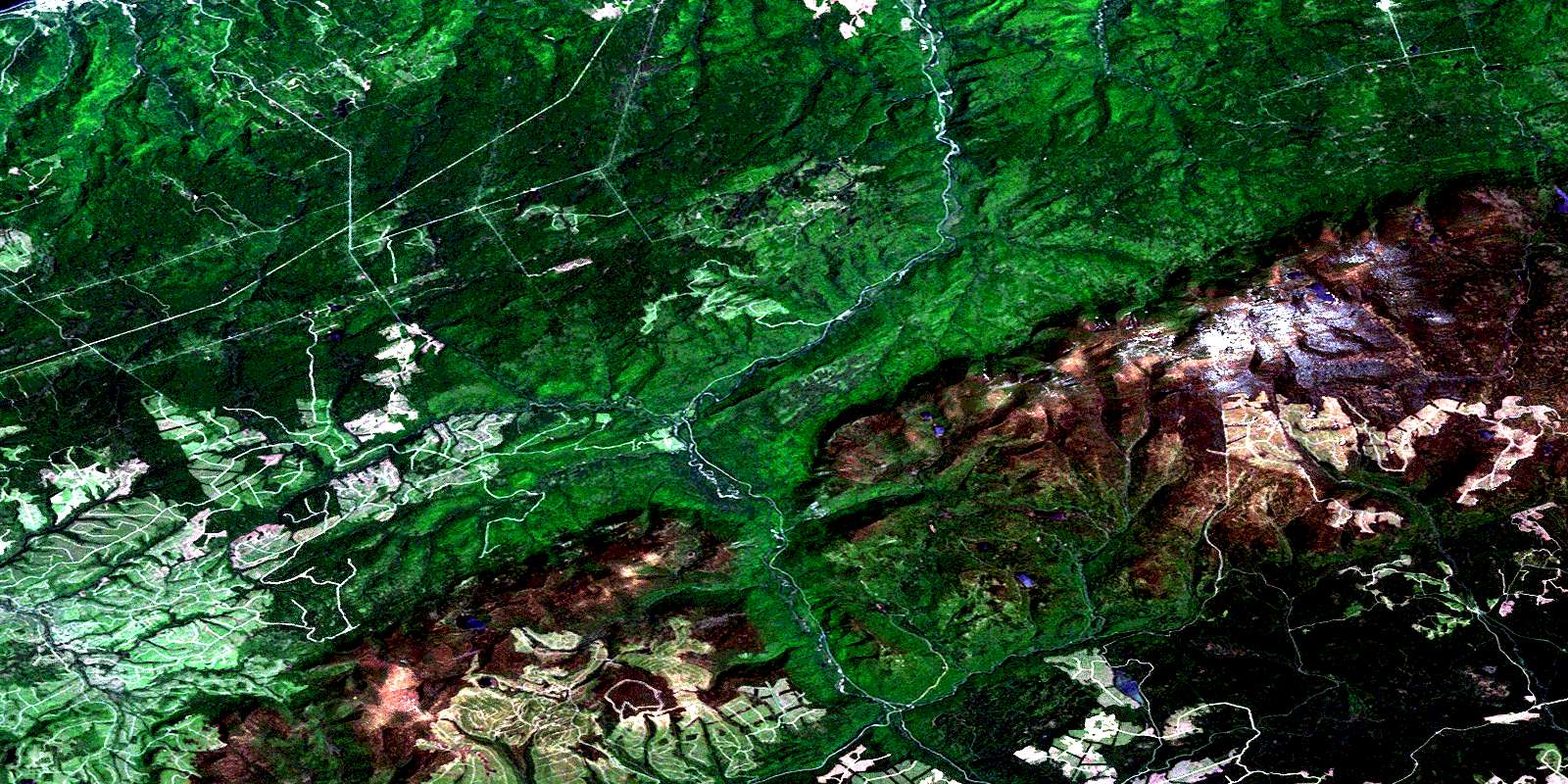
Mont Logan Satellite Image Map
Download Free Aerial Photo 022B15 at 1:50,000 scale
Mont Logan Satellite Imagery
To view this satellite map, mouse over the air photo on the right.
You can also download this satellite image map for free:
022B15 Mont Logan high-resolution satellite image map.
Maps for the Mont Logan aerial map sheet 022B15 at 1:50,000 scale are also available in these versions:
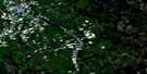
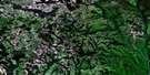
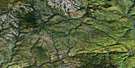
Mont Logan Surrounding Area Aerial Photo Maps
 |
 |
 |
 |
 |
 |
 |
 |
 |
 |
 |
 |
 |
 |
 |
 |
© Department of Natural Resources Canada. All rights reserved.
Mont Logan Gazetteer
The following places can be found on satellite image map 022B15 Mont Logan:
Mont Logan Satellite Image: Bays
Bassin de PeaseMont Logan Satellite Image: Capes
Morne de GlaceMont Logan Satellite Image: City
Cap-ChatMont Logan Satellite Image: Falls
Chute du MemChute Hélène
Chutes Beaulieu
La Grande Cascade
Le Petit Sault
Les Cascades
Mont Logan Satellite Image: Geographical areas
Cap-ChatCherbourg
Courcelette
Dalibaire
Division d'enregistrement de Matane
Dunière
Faribault
Joffre
Le Clercq
Leclercq
Richard
Romieu
Mont Logan Satellite Image: Lakes
Deuxième lac des ÎlesÉtang de la Montagne
Étang Moose
Étang Tallard
Lac à Bessons
Lac à Bidou-Lévesque
Lac à Bouchard
Lac à Catin
Lac à Clovis-Lavoie
Lac à Foin
Lac à Jos-Gagnon
Lac à Jules-Raymond
Lac à la Truite
Lac à Lepage
Lac à l'Équerre
Lac à Rosaire
Lac à Tonio-Tremblay
Lac au Sable
Lac Barbarin
Lac Bardey
Lac Beaulieu
Lac Behrend
Lac Bélone
Lac Bernier
Lac Bromley
Lac Cap-Chat
Lac Carré
Lac Carré
Lac Chic
Lac Chichenko
Lac Choc
Lac Cid
Lac Coleman
Lac Côté
Lac de la Roche
Lac de l'Orignal
Lac des Cadets
Lac des Chaises
Lac des Colons
Lac des Femmes
Lac Dor
Lac du Caribou
Lac du Morne de Glace
Lac du Versant
Lac du Vison
Lac Gagnon
Lac Guillemette
Lac Hamilton
Lac Harrison
Lac Joffre
Lac Leclercq
Lac Man
Lac McLaughlin
Lac Nicol-Albert
Lac Pérot
Lac Rivard
Lac Rond
Lac Rouleau
Lac Savoie
Lac Solitaire
Lac T
Lac Vignon
Lac Windsor
Lac Windsor
Lac Xavier
Lacs à Bernier
Lacs des Îles
Lacs des Îles
Lacs des Petits Chic-Chocs
Lacs Lévesque
Les Petits Étangs
Petit lac Cap-Chat
Petit lac du Moulin
Petit lac Guillemette
Petit lac Nicol-Albert
Petit lac Penché
Premier lac des Îles
Mont Logan Satellite Image: Miscellaneous
Bassin FernaldForêt ancienne des Monts-Chic-Chocs
Passe Fernald
Vasière de la Zone 30
Mont Logan Satellite Image: Mountains
La Grande ArêteLe Frère de Nicol-Albert
Mont Ala'sui'nui
Mont Bayfield
Mont Beaulieu
Mont Blanc
Mont Coleman
Mont Coleman Ouest
Mont Collins
Mont Craggy
Mont des Disparus
Mont des Fougères
Mont des Loupes
Mont Desjardins
Mont Dodge
Mont Fernand-Fafard
Mont Fortin
Mont Griscom
Mont Jacques-Ferron
Mont Jean-Yves-Bérubé
Mont Jimmy-Russell
Mont Logan
Mont Louis-Marie-Lalonde
Mont Matawees
Mont Nicol-Albert
Mont Pembroke
Mont Pointu
Mont Séverin-Pelletier
Mont Val d'Or
Montagne de la Queue des Loutres
Montagne des Panaches
Montagne du Français
Montagne Hélène
Monts Chic-Chocs
Monts Shickshock
Mont Logan Satellite Image: Other municipal/district area - miscellaneous
Circonscription électorale de MataneCoulée-des-Adolphe
Mont-Albert
Rivière-Bonjour
Mont Logan Satellite Image: Conservation areas
Parc de conservation de la GaspésieParc national de la Gaspésie
Réserve écologique Fernald
Réserve faunique de Cap-Chat
Réserve faunique de Dunière
Réserve faunique de la Rivière-Cap-Chat
Réserve faunique de Matane
Zec de Cap-Chat
Zec de la Rivière-Cap-Chat
Mont Logan Satellite Image: Rapids
Le Petit SaultRapide à Bob
Rapide à Win
Mont Logan Satellite Image: Rivers
Branche EstCoulée à Norbert-Lemieux
Coulée à Wellie
Coulée des Chaises
Coulée des Chasseurs
Coulée des Gaudreault
Coulée du Vison
Décharge du Lac à la Truite
Fleuve Saint-Laurent
La Serpentine
Le Gros Ruisseau
Le Petit Bras
Petit ruisseau Côté
Petite rivière Cap-Chat
Petite rivière Cap-Chat Est
Rivière à Pierre
Rivière Cap-Chat
Rivière Cap-Chat Est
Rivière des Grands Capucins
Rivière des Grands Méchins
Rivière des Grands Méchins Ouest
Rivière du Grand Capucin
Rivière Isabelle
Rivière Matane
Rivière Pineault
Ruisseau à Patates
Ruisseau à Patates
Ruisseau à Pierre
Ruisseau Alphonse
Ruisseau Antoine
Ruisseau au Coin
Ruisseau Aumay
Ruisseau aux Perdrix
Ruisseau aux Saumons
Ruisseau Bascon
Ruisseau Bauvas
Ruisseau Beaulieu
Ruisseau Beauzèle
Ruisseau Bélone
Ruisseau Bernier
Ruisseau Bouynot
Ruisseau Bricault
Ruisseau Bridge
Ruisseau Brisebois
Ruisseau Cash
Ruisseau Chlorite
Ruisseau Côté
Ruisseau Dauzay
Ruisseau de la Cassette
Ruisseau de la Chaîne
Ruisseau de la Loutre
Ruisseau de l'Échouement
Ruisseau de l'Islet
Ruisseau des Adolphe
Ruisseau des Prairies
Ruisseau Donetgay
Ruisseau du Camp
Ruisseau du Vingt-Troisième Mille
Ruisseau Ferré
Ruisseau Ferry
Ruisseau Ferry
Ruisseau First Fork
Ruisseau Gallian
Ruisseau Gandon
Ruisseau Go-a-Shore
Ruisseau Goineau
Ruisseau Halloway
Ruisseau Hamilton
Ruisseau Isabelle
Ruisseau Jean
Ruisseau Junier
Ruisseau Kine
Ruisseau Landry
Ruisseau Luiset
Ruisseau Mallet
Ruisseau Mem
Ruisseau Musard
Ruisseau Northwest
Ruisseau Ouelette
Ruisseau Ouellet
Ruisseau Ouellet Ouest
Ruisseau Paris
Ruisseau Paul
Ruisseau Pellan
Ruisseau Perdu
Ruisseau Pineault
Ruisseau Primeau
Ruisseau Reignal
Ruisseau Rioux
Ruisseau Roaring
Ruisseau Russell
Ruisseau Short
Ruisseau Snake
Ruisseau Split
Ruisseau Steep Hill
Ruisseau Vandette
Ruisseau Voligny
Ruisseau Vyette
Ruisseau Wilson
RuisseauKeable
Mont Logan Satellite Image: River features
La Queue des LoutresLe Grand Bras
Mont Logan Satellite Image: Road features
Pont de la Branche-de-l'EstPont de la Hauteur-des-Eaux
Pont de la Montagne-des-Panaches
Pont des Fonds
Pont du Camp-Faribault
Pont du Lac-Barbarin
Pont du Lac-Cid
Pont du Père-Forbes
Pont du Ruisseau-Alphonse
Pont du Ruisseau-à-Pierre
Pont du Ruisseau-Bascon
Pont du Wilson
Pont Faribault
Pont Pineault
Pont Primeau
Pont Richardson
Sentier du Petit-Sault
Sentier international des Appalaches
Mont Logan Satellite Image: Shoals
Fosse à YvonFosse McLaughlin
Fosse Noire
Mont Logan Satellite Image: Unincorporated areas
CherbourgDalibaire-Ouest
Grands-Méchins
La Barrière-de-la-Chaîne
La Primore
L'Ancien-Moulin-à-Pineault
Le Camp-Faribault
Le Camp-Nector
Le Camp-Nictor
Le Go Ashore
Romieu
Romieu-Sud
Saint-Bède
Saint-Octave-de-l'Avenir
Saint-Paulin-Dalibaire
Saint-Thomas-de-Cherbourg
Mont Logan Satellite Image: Valleys
Canyon de la Rivière Cap-ChatCoulée de la Dame
Coulée de la Grande Acul
Coulée des Adolphe
Coulée du Gendarme
Coulée du Lac Windsor
Coulée du Morne de Glace
Coulée Ferry
Coulée Germain
Coulée Halloway
Ravin à Neige
Vallée de la Rivière Cap-Chat
Vallée Suspendue
Mont Logan Satellite Image: Low vegetation
Margouillère de la PineaultVasières de la Coulée Halloway
Mont Logan Satellite Image: Villages
CapucinsLes Méchins
Saint-Paulin-Dalibaire
Saint-Thomas-de-Cherbourg
© Department of Natural Resources Canada. All rights reserved.
022B Related Maps:
022B Matane022B01 Escuminac
022B02 Oak-Bay
022B03 Milnikek
022B04 Lac Des Chasseurs
022B05 Lac-Humqui
022B06 Causapscal
022B07 Ruisseau Jerome
022B08 Riviere Angers
022B09 Monts Berry
022B10 Riviere Bonjour
022B11 St-Jean-Baptiste-Vianney
022B12 Sayabec
022B13 Matane
022B14 Ste-Felicite
022B15 Mont Logan
022B16 Mont Albert
