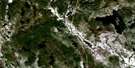
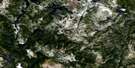
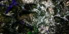
Lac Dufresne Satellite Image Map
Download Free Aerial Photo 022P05 at 1:50,000 scale
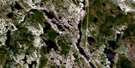
Lac Dufresne Satellite Imagery
To view this satellite map, mouse over the air photo on the right.
You can also download this satellite image map for free:
022P05 Lac Dufresne high-resolution satellite image map.
Maps for the Lac Dufresne aerial map sheet 022P05 at 1:50,000 scale are also available in these versions:
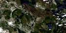
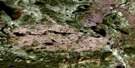
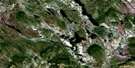
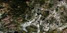
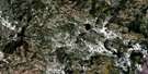
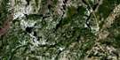
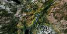
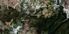
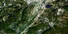
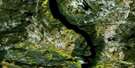
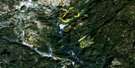
Lac Dufresne Surrounding Area Aerial Photo Maps
 |
 |
 |
 |
 |
 |
 |
 |
 |
 |
 |
 |
 |
 |
 |
 |
© Department of Natural Resources Canada. All rights reserved.
Lac Dufresne Gazetteer
The following places can be found on satellite image map 022P05 Lac Dufresne:
Lac Dufresne Satellite Image: Lakes
Lac AldeuxLac Alun
Lac aux Méandres
Lac Caribou
Lac Carmelle
Lac Croissant
Lac Dangereux
Lac de la Grêle
Lac de la Roche
Lac des Deux Baies
Lac des Trois Îles
Lac Dinosaure
Lac Doiron
Lac du Banc de Sable
Lac Dufresne
Lac la Mule
Lac Labrie
Lac Métaoca
Lac Miche
Lac Mistamoue
Lac Orignal
Lac Perdrix
Lac Touladi
Lac Tremblay
Lac Volant
Lac Waco
Lac Wacouno
Lac Washa-Coush-Noon
Lacs Siamois
Petit lac Brûlé
Lac Dufresne Satellite Image: Other municipal/district area - miscellaneous
Rivière-NipissisLac Dufresne Satellite Image: Rivers
Rivière KachipitonkasRivière Matinipi
Rivière Mistamoue
Rivière Nipissis
Rivière Wacouno
Ruisseau du Portage des Roches
Lac Dufresne Satellite Image: Unincorporated areas
CanaticheWaco

© Department of Natural Resources Canada. All rights reserved.
022P Related Maps:
022P Lac Fournier022P01 Riviere Poisset
022P02 Riviere Baune
022P03 Lac A L'Aigle
022P04 Lac Canatiche
022P05 Lac Dufresne
022P06 Lac Vital
022P07 Lac Catignan
022P08 Lac Verrier
022P09 Lac Bellanca
022P10 Lacs Belmont
022P11 Lac Fournier
022P12 Lac Wacouno
022P13 Lac Eric
022P14 Lac Fleur-De-May
022P15 Domagaya Lake
022P16 Lac Thevet
