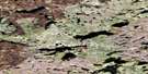
Spitfire Lake Satellite Image Map
Download Free Aerial Photo 075B13 at 1:50,000 scale
Spitfire Lake Satellite Imagery
To view this satellite map, mouse over the air photo on the right.
You can also download this satellite image map for free:
075B13 Spitfire Lake high-resolution satellite image map.
Maps for the Spitfire Lake aerial map sheet 075B13 at 1:50,000 scale are also available in these versions:
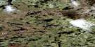
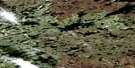
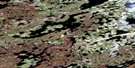
Spitfire Lake Surrounding Area Aerial Photo Maps
 |
 |
 |
 |
 |
 |
 |
 |
 |
 |
 |
 |
 |
 |
 |
 |
© Department of Natural Resources Canada. All rights reserved.
Spitfire Lake Gazetteer
The following places can be found on satellite image map 075B13 Spitfire Lake:
Spitfire Lake Satellite Image: Lakes
Hurricane LakeNarwhal Lake
Spearfish Lake
Spitfire Lake
Spitfire Lake Satellite Image: Rivers
Thoa River
© Department of Natural Resources Canada. All rights reserved.
075B Related Maps:
075B Abitau Lake075B01 Bouvier Bay
075B02 Glass Lake
075B03 Dunvegan Lake
075B04 Huntington Lake
075B05 Meadows Lake
075B06 Penzance Lake
075B07 Carleton Lake
075B08 No Title
075B09 Odin Lake
075B10 Insula Lake
075B11 Tite Lake
075B12 No Title
075B13 Spitfire Lake
075B14 Geeves Lake
075B15 No Title
075B16 Hostile Lake
