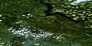
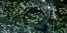
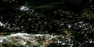
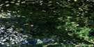
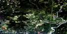
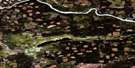
Carp Lake Satellite Image Map
Download Free Aerial Photo 093J14 at 1:50,000 scale
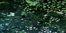
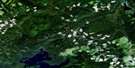
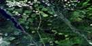
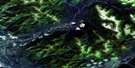
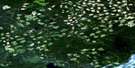
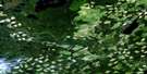
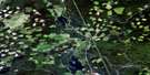
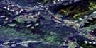
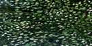
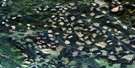
Carp Lake Satellite Imagery
To view this satellite map, mouse over the air photo on the right.
You can also download this satellite image map for free:
093J14 Carp Lake high-resolution satellite image map.
Maps for the Carp Lake aerial map sheet 093J14 at 1:50,000 scale are also available in these versions:
Carp Lake Surrounding Area Aerial Photo Maps
 |
 |
 |
 |
 |
 |
 |
 |
 |
 |
 |
 |
 |
 |
 |
 |
© Department of Natural Resources Canada. All rights reserved.
Carp Lake Gazetteer
The following places can be found on satellite image map 093J14 Carp Lake:
Carp Lake Satellite Image: Bays
Drumlin BayKettle Bay
Sekani Bay
Till Bay
Carp Lake Satellite Image: Falls
War FallsCarp Lake Satellite Image: Indian Reserves
Blue Lake 24Carp Lake Indian Reserve 3
McLeod Lake Indian Reserve 1
Réserve indienne Carp Lake 3
Réserve indienne McLeod Lake 1
Réserve indienne War Lake 4
War Lake Indian Reserve 4
Weedon Carp 6
Carp Lake Satellite Image: Islands
Alder IslandAspen Island
Birch Island
Black Spruce Island
Fir Island
Pine Island
Spirea Island
White Spruce Island
Carp Lake Satellite Image: Lakes
Ant LakeBlue Lake
Bonnington Lake
Boot Jack Lake
Carp Lake
Fluff Lake
Garnetred Lake
Iroquois Lake
Loch Lang
McLeod Lake
Minnow Lake
Monk Lake
Munlo Lake
Rainbow Lake
Sekani Lake
Snowshoe Lake
Swamp Grass Lake
War Lake
Warhorse Lake
Whisper Lake
Windy Lake
Carp Lake Satellite Image: Mountains
Ant HillCarp Hill
Carp Lake Satellite Image: Major municipal/district area - major agglomerations
Regional District of Bulkley-NechakoRegional District of Fraser-Fort George
Carp Lake Satellite Image: Conservation areas
Carp Lake ParkFort McLeod Historic Park
Carp Lake Satellite Image: Plains
Interior PlateauNechako Plateau
Carp Lake Satellite Image: Rivers
Bonnington CreekDes Creek
Garnetred Creek
Hammett Creek
Holder Creek
Iroquois Creek
McDougall River
McLeod River
Moffatt Creek
Pack River
Pan Creek
Pelton Creek
Pyrite Creek
Reed Creek
Rocker Creek
Carp Lake Satellite Image: Unincorporated areas
Fort McLeodMcLeod Lake

© Department of Natural Resources Canada. All rights reserved.
093J Related Maps:
093J Mcleod Lake093J01 Giscome
093J02 Salmon Valley
093J03 Saxton Lake
093J04 Knight Creek
093J05 Great Beaver Lake
093J06 Bugle Lake
093J07 Summit Lake
093J08 Averil Lake
093J09 Hominka River
093J10 Tacheeda Lakes
093J11 Weedon Lake
093J12 Carrier Lake
093J13 Salmon Lake
093J14 Carp Lake
093J15 Firth Lake
093J16 Anzac River
