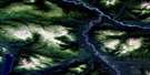
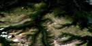
Eaglenest Creek Satellite Image Map
Download Free Aerial Photo 104H11 at 1:50,000 scale
Eaglenest Creek Satellite Imagery
To view this satellite map, mouse over the air photo on the right.
You can also download this satellite image map for free:
104H11 Eaglenest Creek high-resolution satellite image map.
Maps for the Eaglenest Creek aerial map sheet 104H11 at 1:50,000 scale are also available in these versions:
Eaglenest Creek Surrounding Area Aerial Photo Maps
 |
 |
 |
 |
 |
 |
 |
 |
 |
 |
 |
 |
 |
 |
 |
 |
© Department of Natural Resources Canada. All rights reserved.
Eaglenest Creek Gazetteer
The following places can be found on satellite image map 104H11 Eaglenest Creek:
Eaglenest Creek Satellite Image: Lakes
Cartmel LakeTsargoss Lake
Eaglenest Creek Satellite Image: Mountains
Abethledua MountainCartmel Mountain
Eaglenest Range
Mount Cartmel
Skeena Mountains
Eaglenest Creek Satellite Image: Major municipal/district area - major agglomerations
Regional District of Kitimat-StikineEaglenest Creek Satellite Image: Conservation areas
Spatsizi Plateau Wilderness ParkEaglenest Creek Satellite Image: Plains
Stikine PlateauEaglenest Creek Satellite Image: Rivers
Abethledue CreekEaglenest Creek
Klappan River
Levis Creek
Little Klappan River
Tsanadto Creek
Tsatia Creek
Tsetia Creek
Waterfall Creek
Eaglenest Creek Satellite Image: Valleys
Ice Box Canyon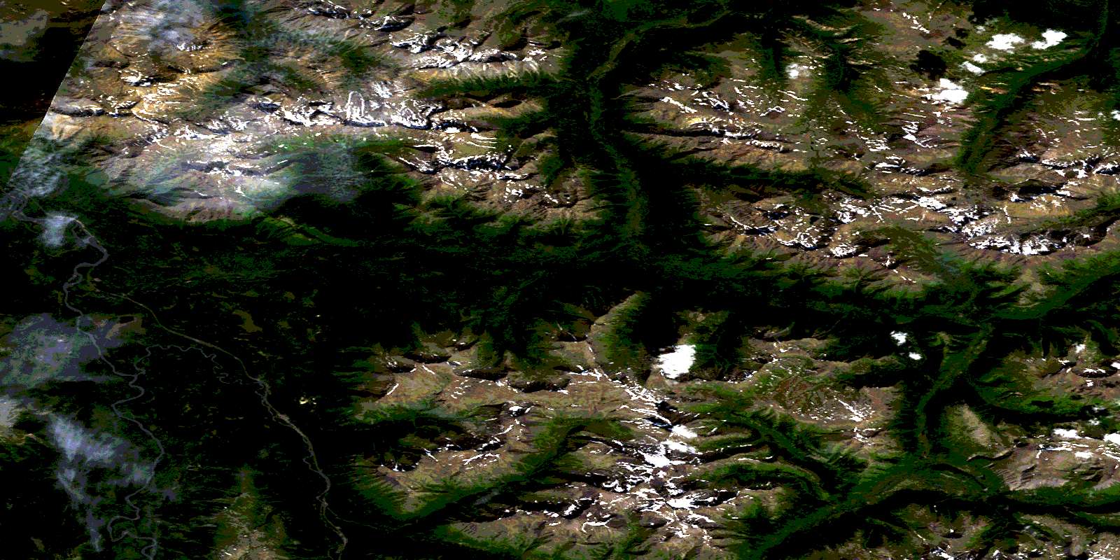
© Department of Natural Resources Canada. All rights reserved.
104H Related Maps:
104H Spatsizi River104H01 Skelhorne Creek
104H02 Tahtsedle Creek
104H03 Sweeny Creek
104H04 Tumeka Lake
104H05 Maitland Creek
104H06 No Title
104H07 Buckinghorse Creek
104H08 Tuaton Lake
104H09 Dawson River
104H10 Cold Fish Lake
104H11 Eaglenest Creek
104H12 Kluea Lake
104H13 Ealue Lake
104H14 Cullivan Creek
104H15 Cambridge Creek
104H16 Diamond Creek
