Byron Bay Topo Map Online
Download Free Topo Map Sheet 013I12 at 1:50,000 scale
013I12 Byron Bay Topo Map
To view this map, mouse over the map preview on the right.
You can also download this topo map for free:
013I12 Byron Bay high-resolution topo map image.
Maps for the Byron Bay topo map sheet 013I12 at 1:50,000 scale are also available in these versions:
Byron Bay Surrounding Area Topo Maps
 |
|||
 |
 |
||
 |
 |
 |
|
 |
 |
© Department of Natural Resources Canada. All rights reserved.
Byron Bay Gazetteer
The following places can be found on topographic map sheet 013I12 Byron Bay:
Byron Bay Topo Map: Bays
Byron BayJeanette Bay
Mostyn Cove
Ship Harbour
Byron Bay Topo Map: Capes
Cape RougeRed Rock Point
Ship Head
Byron Bay Topo Map: Rivers
Big BrookBig River
Black Brook
Bob's Brook
St. Michaels River
Byron Bay Topo Map: Seas
Labrador SeaMer du Labrador
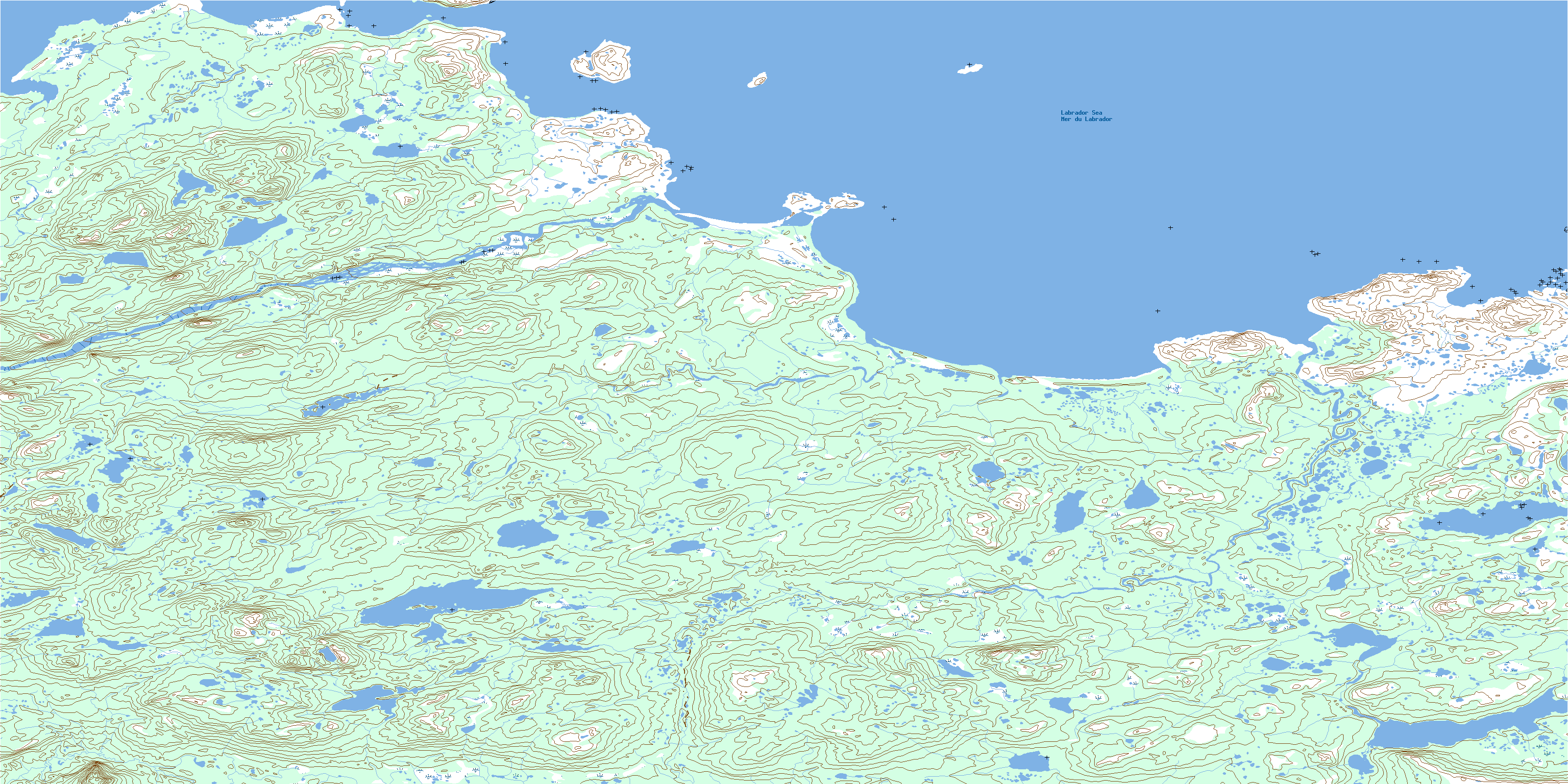
© Department of Natural Resources Canada. All rights reserved.
013I Related Maps:
013I Groswater Bay013I03E West Bay
013I03W West Bay
013I04E Tinker Harbour
013I04W Tinker Harbour
013I05E Pottles Bay
013I05W Pottles Bay
013I06E Indian Harbour
013I06W Indian Harbour
013I07W White Bear Island
013I11E Holton Harbour
013I11W Holton Harbour
013I12E Byron Bay
013I12W Byron Bay
013I13W Cape Harrison
