Natsiaq Peak Topo Map Online
Download Free Topo Map Sheet 027F13 at 1:50,000 scale
027F13 Natsiaq Peak Topo Map
To view this map, mouse over the map preview on the right.
You can also download this topo map for free:
027F13 Natsiaq Peak high-resolution topo map image.
Maps for the Natsiaq Peak topo map sheet 027F13 at 1:50,000 scale are also available in these versions:
Natsiaq Peak Surrounding Area Topo Maps
 |
 |
||
 |
 |
||
 |
 |
||
© Department of Natural Resources Canada. All rights reserved.
Natsiaq Peak Gazetteer
The following places can be found on topographic map sheet 027F13 Natsiaq Peak:
Natsiaq Peak Topo Map: Bays
Gibbs FiordRefuge Harbour
Natsiaq Peak Topo Map: Capes
Remote PeninsulaNatsiaq Peak Topo Map: Islands
Sillem IslandNatsiaq Peak Topo Map: Mountains
Aglu PeakKisimngiuqtuq Peak
Mount Longstaff
Natsiaq Peak
Nauttiaq Peak
Tullik Peak
Natsiaq Peak Topo Map: Valleys
Stewart Valley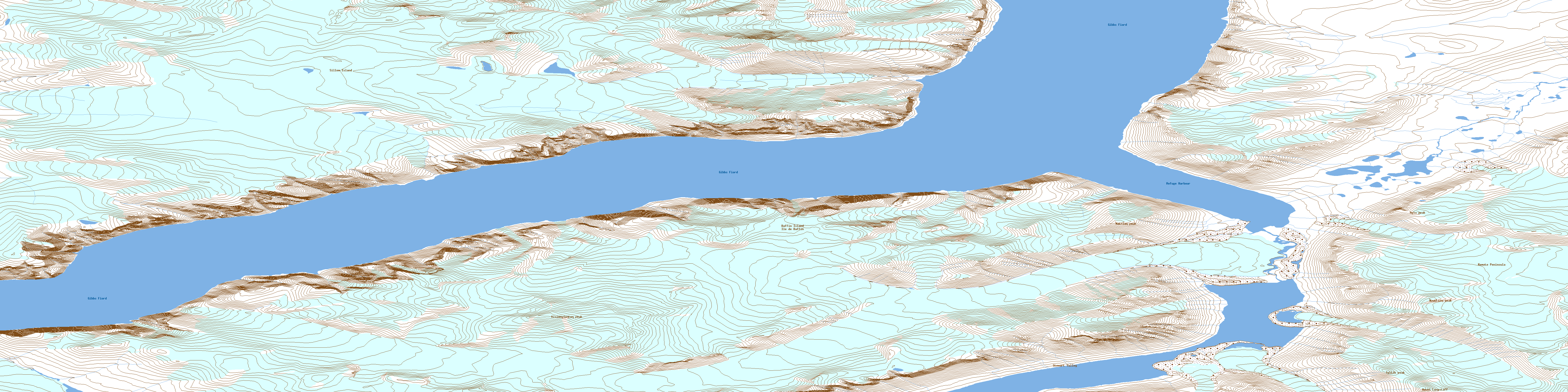
© Department of Natural Resources Canada. All rights reserved.
