Weggs Island Topo Map Online
Download Free Topo Map Sheet 035I06 at 1:50,000 scale
035I06 Weggs Island Topo Map
To view this map, mouse over the map preview on the right.
You can also download this topo map for free:
035I06 Weggs Island high-resolution topo map image.
Maps for the Weggs Island topo map sheet 035I06 at 1:50,000 scale are also available in these versions:
Weggs Island Surrounding Area Topo Maps
 |
 |
||
 |
 |
 |
 |
© Department of Natural Resources Canada. All rights reserved.
Weggs Island Gazetteer
The following places can be found on topographic map sheet 035I06 Weggs Island:
Weggs Island Topo Map: Bays
Baie FoulWeggs Island Topo Map: Capes
Cap de la SalamandreCap du Palmier
Cap La Forest
Cap Qairusualuk
Cap Tikaaguti
Pointe Radisson
Weggs Island Topo Map: Channels
Détroit d'HudsonWeggs Island Topo Map: Islands
Outer IslandWeggs Island
Weggs Island Topo Map: Lakes
Lac AlavinaarniWeggs Island Topo Map: Rivers
Rivière Hengan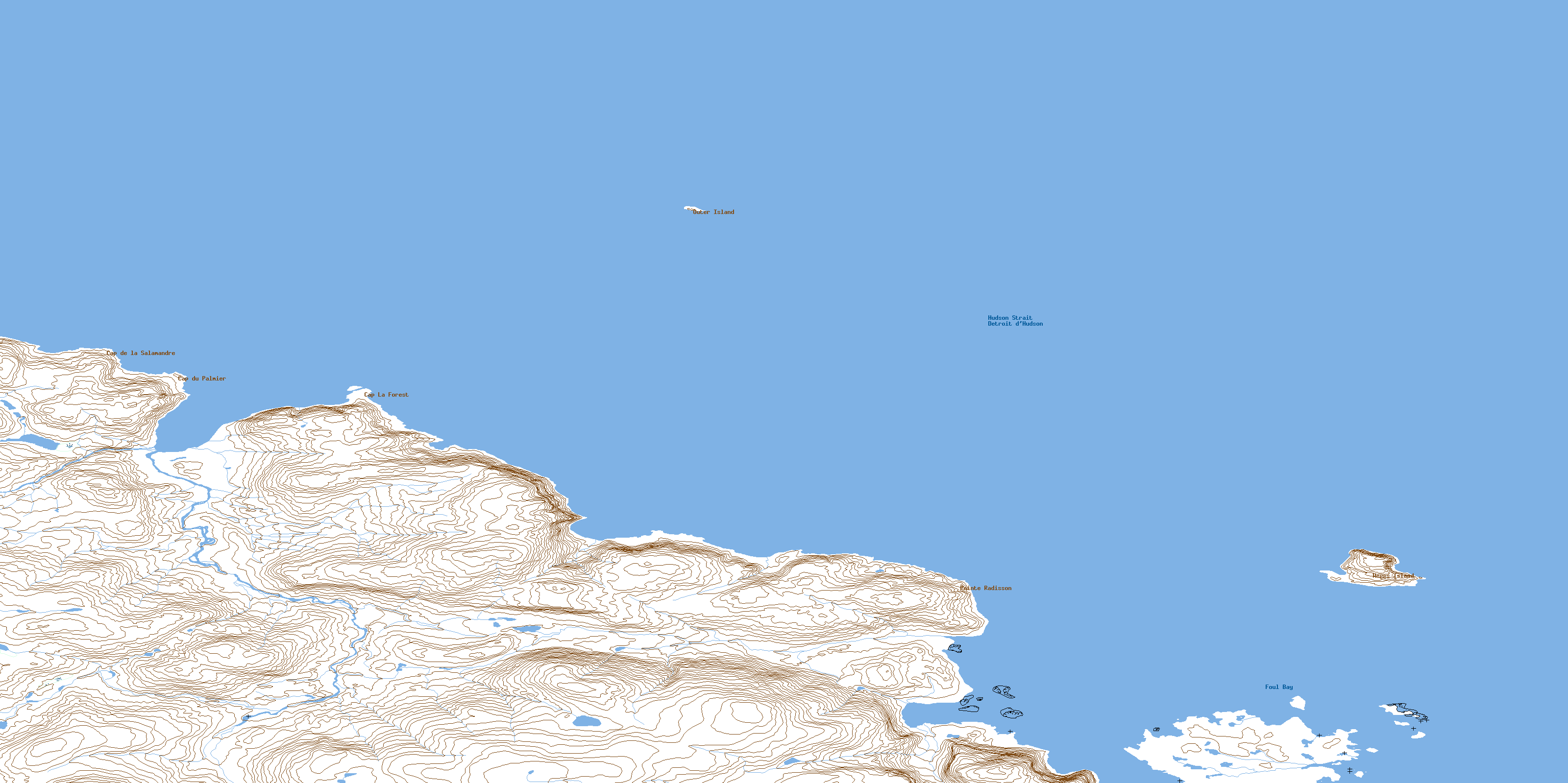
© Department of Natural Resources Canada. All rights reserved.
