Pelee Island Topo Map Online
Download Free Topo Map Sheet 040G15 at 1:50,000 scale
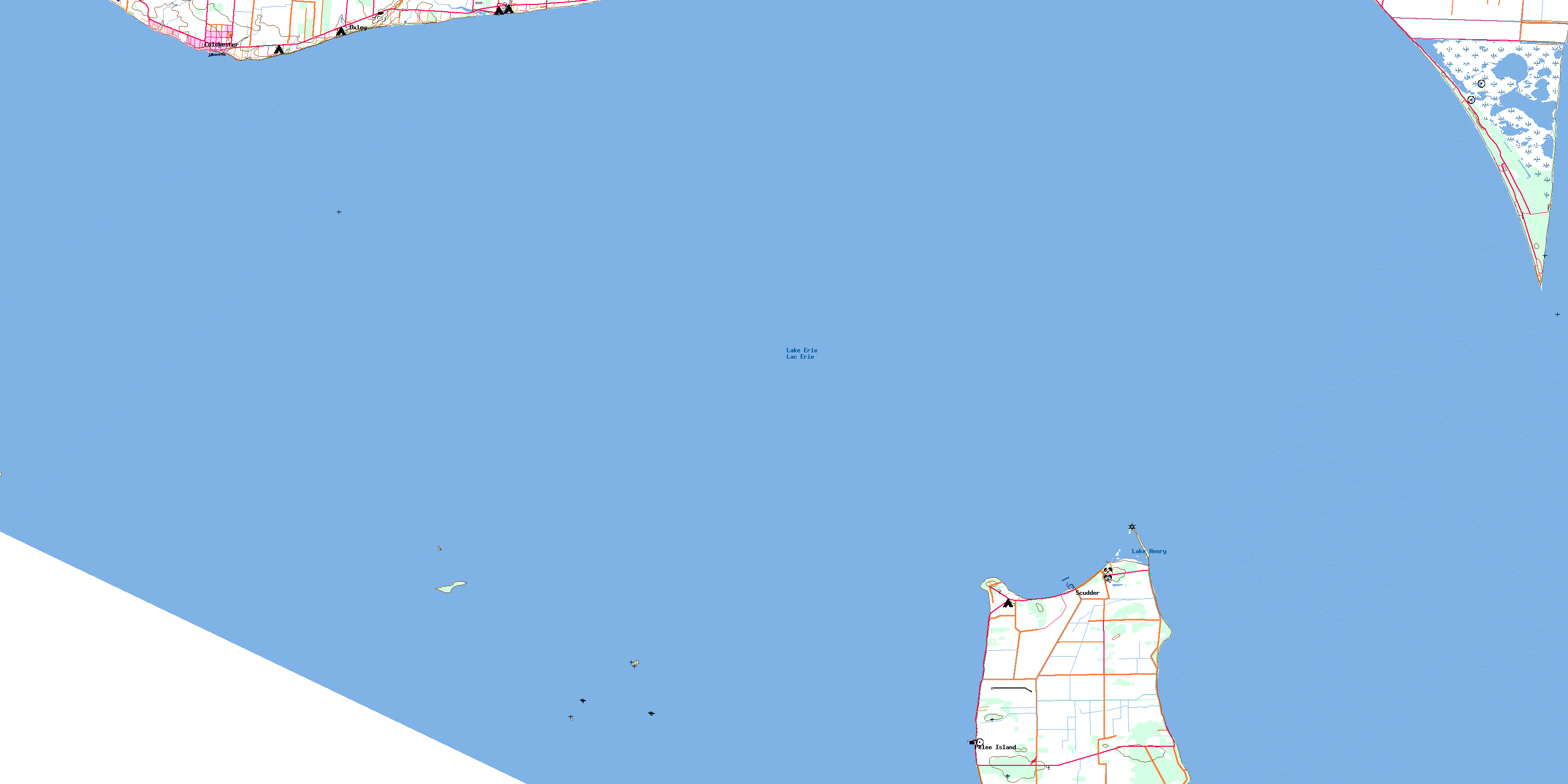
040G15 Pelee Island Topo Map
To view this map, mouse over the map preview on the right.
You can also download this topo map for free:
040G15 Pelee Island high-resolution topo map image.
Maps for the Pelee Island topo map sheet 040G15 at 1:50,000 scale are also available in these versions:
Pelee Island Surrounding Area Topo Maps
 |
|||
 |
|||
© Department of Natural Resources Canada. All rights reserved.
Pelee Island Gazetteer
The following places can be found on topographic map sheet 040G15 Pelee Island:
Pelee Island Topo Map: Bays
North BayPigeon Bay
Pelee Island Topo Map: Beaches
Black Willow BeachEast Beach
East Point Beach
Marentette Beach
Northwest Beach
West Beach
Pelee Island Topo Map: Capes
Lighthouse PointLittles Point
Lizard Point
Middle Point
Mill Point
Pelee Point
Point Pelee
Sheridan Point
Pelee Island Topo Map: Channels
Pelee PassagePelee Island Topo Map: Geographical areas
ColchesterEssex
Gosfield
Mersea
Pelee
Pelee Island Topo Map: Islands
Big Chicken IslandChick Island
East Sister Island
Hen Island
Little Chicken Island
Middle Sister Island
North Harbour Island
Pelee Island
Pelee Island Topo Map: Lakes
Big PondBush Pond
East Cranberry Pond
Girardin Pond
Lac Érié
Lake Erie
Lake Henry
Lake Pond
Redhead Pond
Round Pond
Sanctuary Pond
West Cranberry Pond
Pelee Island Topo Map: Major municipal/district area - major agglomerations
EssexPelee Island Topo Map: Other municipal/district area - miscellaneous
ColchesterColchester North
Colchester South
Gosfield
Gosfield North
Gosfield South
Mersea
Pelee
Pelée
Pelee Island Topo Map: Conservation areas
East Sister Island Provincial Nature ReserveLighthouse Point Provincial Nature Reserve
Parc national du Canada de la Pointe-Pelée
Point Pelee National Park of Canada
Pelee Island Topo Map: Provinces
OntarioPelee Island Topo Map: Rivers
Dolson's CreekFox Creek
Pelee Island Topo Map: Shoals
Colchester ReefEast Sister Shoal
Grecian Shoal
Grubb Reef
Hen Island Shoal
Hulda's Rock
Middle Ground
North Harbour Island Reef
Western Erie Basin
Pelee Island Topo Map: Towns
EssexKingsville
Leamington
Pelee Island Topo Map: Unincorporated areas
ColchesterGrove Avenue
Klie's Beach
Marentette Beach
Oxley
Pelee Island
Point Pelee
Point Pelee Park
Scudder
© Department of Natural Resources Canada. All rights reserved.
