Glaister Lake Topo Map Online
Download Free Topo Map Sheet 042I09 at 1:50,000 scale
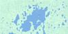
042I09 Glaister Lake Topo Map
To view this map, mouse over the map preview on the right.
You can also download this topo map for free:
042I09 Glaister Lake high-resolution topo map image.
Maps for the Glaister Lake topo map sheet 042I09 at 1:50,000 scale are also available in these versions:
Glaister Lake Surrounding Area Topo Maps
 |
 |
 |
 |
 |
 |
 |
 |
 |
 |
 |
 |
 |
 |
 |
 |
© Department of Natural Resources Canada. All rights reserved.
Glaister Lake Gazetteer
The following places can be found on topographic map sheet 042I09 Glaister Lake:
Glaister Lake Topo Map: Lakes
Glaister LakeMalastikweyau Lake
Wisaskogamau Lake
Glaister Lake Topo Map: Conservation areas
Kesagami Provincial ParkGlaister Lake Topo Map: Rapids
Kanatotik RapidsGlaister Lake Topo Map: Rivers
Black RiverBodell River
Glaister Creek
Kesagami River
Kiasko River
Malastikweyau Creek
Partridge River
Wisaskogamau Creek
© Department of Natural Resources Canada. All rights reserved.
042I Related Maps:
042I Moose River042I01 Ministik Lake
042I02 Mcparlon Lake
042I03 Audrey Lake
042I04 Coral
042I05 Ranoke
042I06 Lyla Lake
042I07 Wekweyaukastik Rapids
042I08 Kesagami Lake
042I09 Glaister Lake
042I10 Kiasko River
042I11 Onakawana
042I12 Pickett Creek
042I13 Birdsall Creek
042I14 Moose River
042I15 Meengan Creek
042I16 Marberg Creek
