Cape Montague Topo Map Online
Download Free Topo Map Sheet 046E06 at 1:50,000 scale
046E06 Cape Montague Topo Map
To view this map, mouse over the map preview on the right.
You can also download this topo map for free:
046E06 Cape Montague high-resolution topo map image.
Maps for the Cape Montague topo map sheet 046E06 at 1:50,000 scale are also available in these versions:
Cape Montague Surrounding Area Topo Maps
 |
 |
 |
|
 |
 |
||
 |
 |
 |
© Department of Natural Resources Canada. All rights reserved.
Cape Montague Gazetteer
The following places can be found on topographic map sheet 046E06 Cape Montague:
Cape Montague Topo Map: Bays
Berthie HarbourBury Cove
Wager Bay
Cape Montague Topo Map: Capes
Cape MontagueCape Montague Topo Map: Channels
Roes Welcome SoundCape Montague Topo Map: Shoals
Ikaariarvik Reef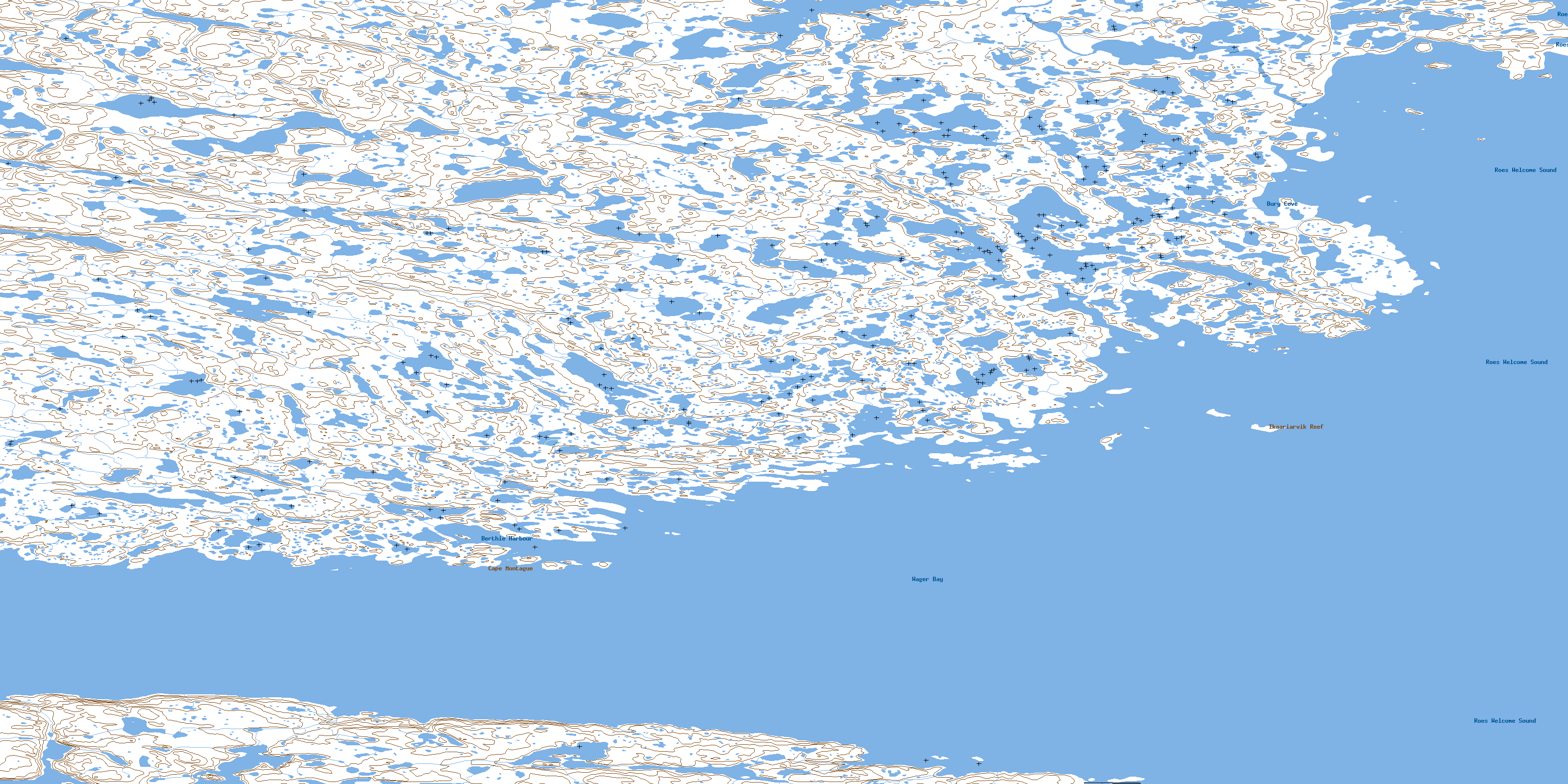
© Department of Natural Resources Canada. All rights reserved.
046E Related Maps:
046E Cape Dobbs046E01 No Title
046E02 Nuvuk Point
046E03 Cape Dobbs
046E04 No Title
046E05 No Title
046E06 Cape Montague
046E08 Battery Bay
046E09 Why-Nee-Yulik Point
046E10 Umiijarvik Point
046E11 No Title
046E12 No Title
046E13 No Title
046E14 No Title
046E15 Tassikadlak Lake
046E16 Smooth Rock Point
