Cape Frigid Topo Map Online
Download Free Topo Map Sheet 046K03 at 1:50,000 scale
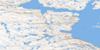
046K03 Cape Frigid Topo Map
To view this map, mouse over the map preview on the right.
You can also download this topo map for free:
046K03 Cape Frigid high-resolution topo map image.
Maps for the Cape Frigid topo map sheet 046K03 at 1:50,000 scale are also available in these versions:
Cape Frigid Surrounding Area Topo Maps
 |
 |
 |
 |
 |
 |
 |
 |
 |
 |
 |
 |
 |
 |
 |
 |
© Department of Natural Resources Canada. All rights reserved.
Cape Frigid Gazetteer
The following places can be found on topographic map sheet 046K03 Cape Frigid:
Cape Frigid Topo Map: Bays
Cleveland HarbourRepulse Bay
Cape Frigid Topo Map: Capes
Beach PointCape Frigid
Cape Middleton
Cape Frigid Topo Map: Channels
Frozen StraitRoes Welcome Sound
Cape Frigid Topo Map: Islands
Bluhme IslandWhite Island
© Department of Natural Resources Canada. All rights reserved.
046K Related Maps:
046K Hurd Channel046K01 Georgina Island
046K02 Bushnan Island
046K03 Cape Frigid
046K04 Beach Point
046K05 Harbour Islands
046K06 Hall Islands
046K07 Palmated Bay
046K08 Gore Bay
046K09 Cape Reid
046K10 No Title
046K11 No Title
046K12 No Title
046K13 No Title
046K14 Tasers Lake
046K15 Sherer Inlet
046K16 Norman Inlet
