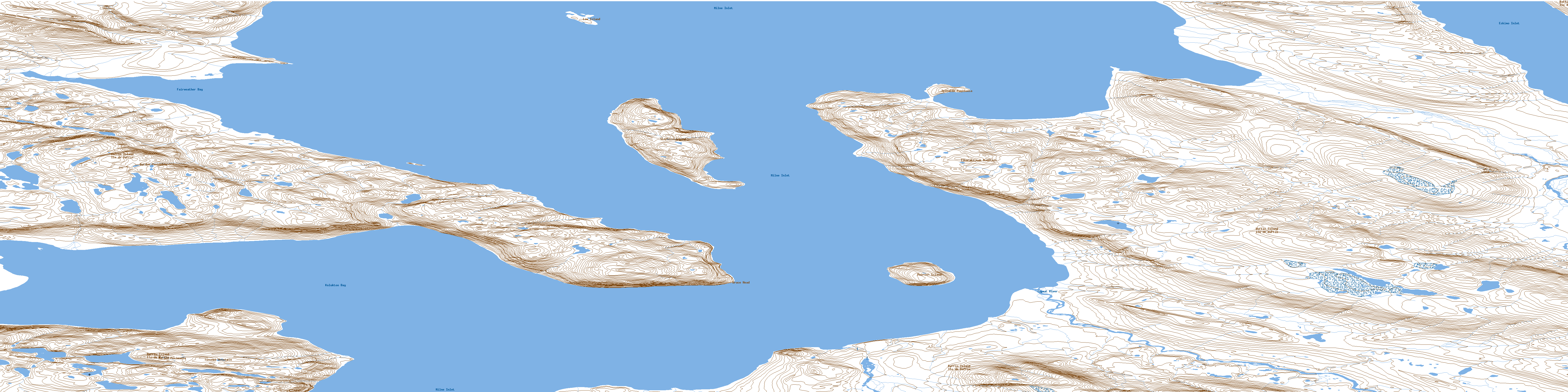
Bruce Head Topo Map Online
Download Free Topo Map Sheet 048A01 at 1:50,000 scale
048A01 Bruce Head Topo Map
To view this map, mouse over the map preview on the right.
You can also download this topo map for free:
048A01 Bruce Head high-resolution topo map image.
Maps for the Bruce Head topo map sheet 048A01 at 1:50,000 scale are also available in these versions:
Bruce Head Surrounding Area Topo Maps
 |
|||
 |
 |
||
 |
 |
||
 |
© Department of Natural Resources Canada. All rights reserved.
Bruce Head Gazetteer
The following places can be found on topographic map sheet 048A01 Bruce Head:
Bruce Head Topo Map: Bays
Assomption HarbourDeep Cove
Eskimo Inlet
Fairweather Bay
Koluktoo Bay
Milky Bay
Milne Inlet
Bruce Head Topo Map: Capes
Borden PeninsulaBruce Head
Ipitalik Peninsula
Razorback Point
Bruce Head Topo Map: Islands
Low IslandPoirier Island
Stephens Island
Bruce Head Topo Map: Mountains
Krag MountainsTikerakdjuak Mountain
Tununek Mountain
Bruce Head Topo Map: Rivers
Robertson RiverTugaat River
Bruce Head Topo Map: Shoals
Lone ShoalSawtooth Ledge
© Department of Natural Resources Canada. All rights reserved.
