Round Island Topo Map Online
Download Free Topo Map Sheet 055N13 at 1:50,000 scale
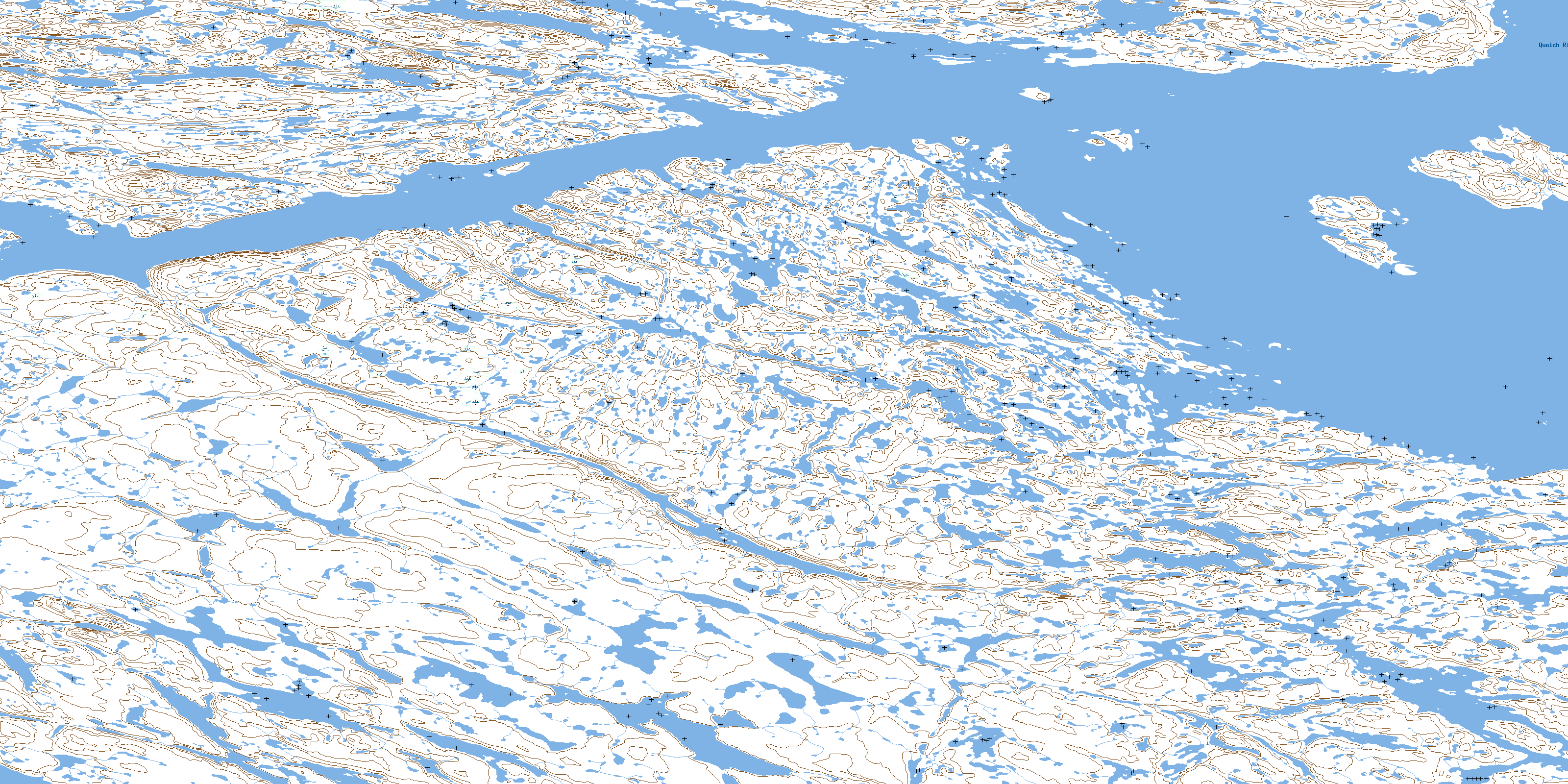
055N13 Round Island Topo Map
To view this map, mouse over the map preview on the right.
You can also download this topo map for free:
055N13 Round Island high-resolution topo map image.
Maps for the Round Island topo map sheet 055N13 at 1:50,000 scale are also available in these versions:
Round Island Surrounding Area Topo Maps
 |
 |
 |
 |
 |
 |
 |
 |
 |
 |
 |
 |
 |
 |
 |
 |
© Department of Natural Resources Canada. All rights reserved.
Round Island Gazetteer
The following places can be found on topographic map sheet 055N13 Round Island:
Round Island Topo Map: Bays
Chesterfield InletCross Bay
Ippijjuaq Bay
Schooner Harbour
Round Island Topo Map: Channels
Brant Island ChannelCross Bay Channel
Round Island Topo Map: Islands
Auk IslandBaleen Island
Bowell Island
Bowell Islands
Brant Island
Helicopter Island
Round Island
Strivewell Island
Round Island Topo Map: Rivers
Quoich RiverRound Island Topo Map: Shoals
Borealis ReefWhite Rock
© Department of Natural Resources Canada. All rights reserved.
055N Related Maps:
055N Gibson Lake055N01 Meliadine Lake
055N02 No Title
055N03 No Title
055N04 No Title
055N05 No Title
055N06 Gibson Lake
055N07 No Title
055N08 Mcmanaman Lake
055N09 Barbour Bay
055N10 Butts Lake
055N11 No Title
055N12 No Title
055N13 Round Island
055N14 Bowser Island
055N15 Akunak Bay
055N16 Robinhood Bay
