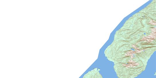
103O01 Ashington Range Topo Map
To view this map, mouse over the map preview on the right.
You can also download this topo map for free:
103O01 Ashington Range high-resolution topo map image.
Maps for the Ashington Range topo map sheet 103O01 at 1:50,000 scale are also available in these versions:
Ashington Range Surrounding Area Topo Maps
© Department of Natural Resources Canada. All rights reserved.
Ashington Range Gazetteer
The following places can be found on topographic map sheet 103O01 Ashington Range:
Ashington Range Topo Map: Bays
Dogfish BayDogfish Bight
Observatory Inlet
Whiskey Bay
Whisky Bay
Ashington Range Topo Map: Capes
Dent BluffDickens Point
Logan Point
Nass Point
Spit Point
Stopford Point
Tree Point
Ashington Range Topo Map: Channels
Pearse CanalPortland Canal
Ashington Range Topo Map: Indian Reserves
Dogfish Bay Indian Reserve 42Kincolith Indian Reserve 14A
Pearse Island Indian Reserve 43
Réserve indienne Dogfish Bay 42
Réserve indienne Kincolith 14A
Réserve indienne Pearse Island 43
Ashington Range Topo Map: Islands
Pearse IslandWindy Island
Ashington Range Topo Map: Mountains
Ashington RangeBoundary Ranges
Chaîne Côtière
Coast Mountains
Mount Jauncey
White Bluff
Ashington Range Topo Map: Major municipal/district area - major agglomerations
Regional District of Kitimat-StikineAshington Range Topo Map: Miscellaneous sites
Wil MilitXmaat'in
© Department of Natural Resources Canada. All rights reserved.


