Homan Lake Topo Map Online
Download Free Topo Map Sheet 104M14 at 1:50,000 scale
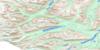
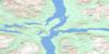
104M14 Homan Lake Topo Map
To view this map, mouse over the map preview on the right.
You can also download this topo map for free:
104M14 Homan Lake high-resolution topo map image.
Maps for the Homan Lake topo map sheet 104M14 at 1:50,000 scale are also available in these versions:
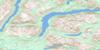
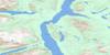
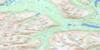
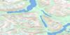
Homan Lake Surrounding Area Topo Maps
 |
 |
 |
 |
 |
 |
 |
|
 |
 |
||
 |
 |
© Department of Natural Resources Canada. All rights reserved.
Homan Lake Gazetteer
The following places can be found on topographic map sheet 104M14 Homan Lake:
Homan Lake Topo Map: Lakes
Bennett LakeDeep Lake
Homan Lake
Lindeman Lake
Long Lake
Mountain Lake
Munroe Lake
Partridge Lake
Homan Lake Topo Map: Mountains
Bennett RangeBoundary Ranges
Chaîne Côtière
Coast Mountains
Mount Foster
Mount Harvey
Mount Van Wagenen
Munroe Peak
Tagish Highland
Tom Thumb Mountain
Homan Lake Topo Map: Rivers
Homan RiverJones Creek
Latreille Creek
Lemieux Creek
Lindeman Creek
Partridge River
Homan Lake Topo Map: Unincorporated areas
GaultLindeman

© Department of Natural Resources Canada. All rights reserved.
