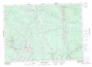
Maps showing McCullough Brook, York, New Brunswick
McCullough Brook is a River located in York, New Brunswick and has an elevation of 19 meters.
- Latitude: 46° 0' 8'' North (decimal: 46.0021589)
- Longitude: 66° 50' 58'' West (decimal: -66.8494018)
- Topography Feature Category: River
- Geographical Feature: Brook
- Canadian Province/Territory: New Brunswick
- Elevation: 19 meters
- Location: York
- Atlas of Canada Locator Map: McCullough Brook
- GPS Coordinate Locator Map: McCullough Brook Lat/Long
McCullough Brook NTS Map Sheets