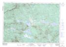
Maps showing Rivière du Loup, Saint-Georges; Beauce-Sartigan, Quebec
Rivière du Loup is a River located in Saint-Georges; Beauce-Sartigan, Quebec and has an elevation of 270 meters.
- Latitude: 46° 5' 22'' North (decimal: 46.0894794)
- Longitude: 70° 39' 2'' West (decimal: -70.6506274)
- Topography Feature Category: River
- Geographical Feature: Rivière
- Canadian Province/Territory: Quebec
- Elevation: 270 meters
- Location: Saint-Georges; Beauce-Sartigan
- Atlas of Canada Locator Map: Rivière du Loup
- GPS Coordinate Locator Map: Rivière du Loup Lat/Long
Rivière du Loup NTS Map Sheets
021E09 Lac Emilie Topographic Map at 1:50,000 scale
021E10 Lac-Megantic Topographic Map at 1:50,000 scale
021E15 La Guadeloupe Topographic Map at 1:50,000 scale
021E16 Saint-Theophile Topographic Map at 1:50,000 scale
021L01 Saint-Zacharie Topographic Map at 1:50,000 scale
021L02 Beauceville Topographic Map at 1:50,000 scale
021E Sherbrooke Topographic Map at 1:250,000 scale
021L Quebec Topographic Map at 1:250,000 scale