Canada Topographic Maps

West Crawford Creek Topo Maps

Topography maps and Latitude/Longitude Location

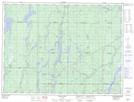
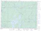
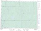
Maps showing West Crawford Creek, Ontario

West Crawford Creek is a River located in Ontario.

  • Latitude: 48° 21' North   (decimal: 48.3499999)
  • Longitude: 81° 58' West   (decimal: -81.9667000)
  • Topography Feature Category: River
  • Geographical Feature: Creek
  • Canadian Province/Territory: Ontario
  • GPS Coordinate Locator Map: West Crawford Creek Lat/Long

West Crawford Creek NTS Map Sheets

042A05 Dana Lake Topographic Map at 1:50,000 scale

042B01 Foleyet Topographic Map at 1:50,000 scale

042B08 Oswald Lake Topographic Map at 1:50,000 scale

042A Timmins Topographic Map at 1:250,000 scale

042B Foleyet Topographic Map at 1:250,000 scale

 
Buy Topographic Maps DVD
Newsletter Sign-up

Yes, I want to receive map store discounts.


Bookmark and Share