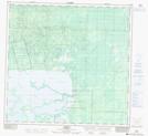
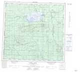
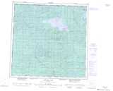
Maps showing Zama River, 113-5-W6, Alberta
Zama River is a River located in 113-5-W6, Alberta and has an elevation of 383 meters.
- Latitude: 58° 51' 24'' North (decimal: 58.8566666)
- Longitude: 118° 50' 21'' West (decimal: -118.8391666)
- Topography Feature Category: River
- Geographical Feature: River
- Canadian Province/Territory: Alberta
- Elevation: 383 meters
- Location: 113-5-W6
- Atlas of Canada Locator Map: Zama River
- GPS Coordinate Locator Map: Zama River Lat/Long
Zama River NTS Map Sheets
084L15 Habay Topographic Map at 1:50,000 scale
084M02 Moody Creek Topographic Map at 1:50,000 scale
084M03 Amber River Topographic Map at 1:50,000 scale
084M06 Wally Lake Topographic Map at 1:50,000 scale
084L Zama Lake Topographic Map at 1:250,000 scale
084M Bistcho Lake Topographic Map at 1:250,000 scale
084M02 Moody Creek Topographic Map at 1:50,000 scale
084M03 Amber River Topographic Map at 1:50,000 scale
084M06 Wally Lake Topographic Map at 1:50,000 scale
084L Zama Lake Topographic Map at 1:250,000 scale
084M Bistcho Lake Topographic Map at 1:250,000 scale