Canada Topographic Maps

Dismal Creek Topo Maps

Topography maps and Latitude/Longitude Location

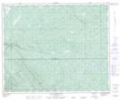
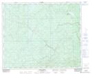
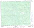
Maps showing Dismal Creek, 47-11-W5, Alberta

Dismal Creek is a River located in 47-11-W5, Alberta and has an elevation of 1101 meters.

  • Latitude: 53° 5' 40'' North   (decimal: 53.0944444)
  • Longitude: 115° 34' 16'' West   (decimal: -115.5711110)
  • Topography Feature Category: River
  • Geographical Feature: Creek
  • Canadian Province/Territory: Alberta
  • Elevation: 1101 meters
  • Location: 47-11-W5
  • Atlas of Canada Locator Map: Dismal Creek
  • GPS Coordinate Locator Map: Dismal Creek Lat/Long

Dismal Creek NTS Map Sheets

083C16 Blackstone River Topographic Map at 1:50,000 scale

083F01 Raven Creek Topographic Map at 1:50,000 scale

083G04 Zeta Lake Topographic Map at 1:50,000 scale

083C Brazeau Lake Topographic Map at 1:250,000 scale

083F Edson Topographic Map at 1:250,000 scale

083G Wabamun Lake Topographic Map at 1:250,000 scale

 
Buy Topographic Maps DVD
Newsletter Sign-up

Yes, I want to receive map store discounts.


Bookmark and Share