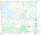
Maps showing Leaman, 36-53-11-W5, Alberta
Leaman is a Unincorporated area located in 36-53-11-W5, Alberta and has an elevation of 795 meters.
- Latitude: 53° 37' 15'' North (decimal: 53.6207840)
- Longitude: 115° 28' 33'' West (decimal: -115.4757685)
- Topography Feature Category: Unincorporated area
- Geographical Feature: Locality
- Canadian Province/Territory: Alberta
- Elevation: 795 meters
- Location: 36-53-11-W5
- Atlas of Canada Locator Map: Leaman
- GPS Coordinate Locator Map: Leaman Lat/Long
Leaman NTS Map Sheets