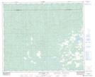
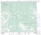
Maps showing Shiningbank Lake, 56-14-W5, Alberta
Shiningbank Lake is a Lake located in 56-14-W5, Alberta and has an elevation of 827 meters.
- Latitude: 53° 52' 1'' North (decimal: 53.8669444)
- Longitude: 116° 1' 29'' West (decimal: -116.0247221)
- Topography Feature Category: Lake
- Geographical Feature: Lake
- Canadian Province/Territory: Alberta
- Elevation: 827 meters
- Location: 56-14-W5
- Atlas of Canada Locator Map: Shiningbank Lake
- GPS Coordinate Locator Map: Shiningbank Lake Lat/Long
Shiningbank Lake NTS Map Sheets