Maps showing Medicine Hat, 12-5-W4, Alberta
Medicine Hat is a City located in 12-5-W4, Alberta and has an elevation of 672 meters.
- Latitude: 50° 2' 27'' North (decimal: 50.0408333)
- Longitude: 110° 40' 36'' West (decimal: -110.6766667)
- Topography Feature Category: City
- Geographical Feature: City
- Canadian Province/Territory: Alberta
- Elevation: 672 meters
- Location: 12-5-W4
- Atlas of Canada Locator Map: Medicine Hat
- GPS Coordinate Locator Map: Medicine Hat Lat/Long
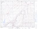
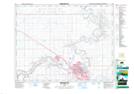
Medicine Hat NTS Map Sheets