Maps showing Municipal District of Sturgeon No. 90, Alberta
Municipal District of Sturgeon No. 90 is a Major municipal/district area - major agglomeration located in Alberta.
- Latitude: 53° 49' 5'' North (decimal: 53.8180999)
- Longitude: 113° 31' 12'' West (decimal: -113.5200000)
- Topography Feature Category: Major municipal/district area - major agglomeration
- Geographical Feature: Municipal District
- Canadian Province/Territory: Alberta
- GPS Coordinate Locator Map: Municipal District of Sturgeon No. 90 Lat/Long
Municipal District of Sturgeon No. 90 NTS Map Sheets
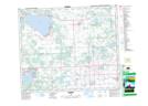
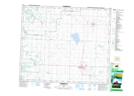
083G09 Onoway Topographic Map at 1:50,000 scale
083G16 Lac La Nonne Topographic Map at 1:50,000 scale
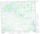
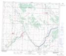
083H11 Edmonton Topographic Map at 1:50,000 scale
083H12 St Albert Topographic Map at 1:50,000 scale
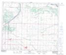
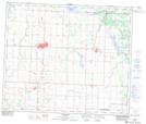
083H13 Morinville Topographic Map at 1:50,000 scale
083H14 Redwater Topographic Map at 1:50,000 scale
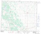
083H15 Lamont Topographic Map at 1:50,000 scale
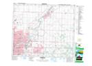
083I03 Thorhild Topographic Map at 1:50,000 scale
083I04 Westlock Topographic Map at 1:50,000 scale
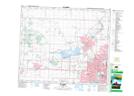
083G Wabamun Lake Topographic Map at 1:250,000 scale
083H Edmonton Topographic Map at 1:250,000 scale
083I Tawatinaw Topographic Map at 1:250,000 scale