Maps showing Municipal District of Cypress No. 1, Alberta
Municipal District of Cypress No. 1 is a Major municipal/district area - major agglomeration located in Alberta.
- Latitude: 49° 52' 23'' North (decimal: 49.8731000)
- Longitude: 110° 40' 51'' West (decimal: -110.6807999)
- Topography Feature Category: Major municipal/district area - major agglomeration
- Geographical Feature: Municipal District
- Canadian Province/Territory: Alberta
- GPS Coordinate Locator Map: Municipal District of Cypress No. 1 Lat/Long
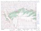
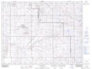
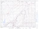
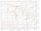
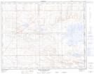
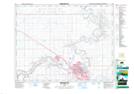
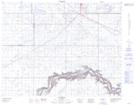
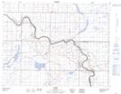
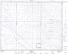
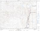
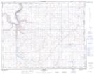
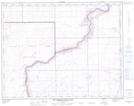
Municipal District of Cypress No. 1 NTS Map Sheets
072E01 Cripple Creek Topographic Map at 1:50,000 scale
072E02 Calib Coulee Topographic Map at 1:50,000 scale
072E07 Manyberries Topographic Map at 1:50,000 scale
072E08 Thelma Creek Topographic Map at 1:50,000 scale
072E09 Elkwater Lake Topographic Map at 1:50,000 scale
072E10 Bulls Head Topographic Map at 1:50,000 scale
072E15 Seven Persons Topographic Map at 1:50,000 scale
072E16 Irvine Topographic Map at 1:50,000 scale
072L01 Many Island Lake Topographic Map at 1:50,000 scale
072L02 Medicine Hat Topographic Map at 1:50,000 scale
072L03 Suffield Topographic Map at 1:50,000 scale
072L04 Hays Topographic Map at 1:50,000 scale
072L06 Alderson Topographic Map at 1:50,000 scale
072L07 Watching Hill Topographic Map at 1:50,000 scale
072L08 Hilda Topographic Map at 1:50,000 scale
072L09 The Middle Sand Hills Topographic Map at 1:50,000 scale
072L10 Easy Coulee Topographic Map at 1:50,000 scale
072L11 Jenner Topographic Map at 1:50,000 scale
072L16 Bindloss Topographic Map at 1:50,000 scale
072E Foremost Topographic Map at 1:250,000 scale
072L Medicine Hat Topographic Map at 1:250,000 scale