Maps showing Gathto Creek, Peace River Land District, British Columbia
Gathto Creek is a River located in Peace River Land District, British Columbia.
- Latitude: 58° 16' North (decimal: 58.2666999)
- Longitude: 123° 37' West (decimal: -123.6166999)
- Topography Feature Category: River
- Geographical Feature: Creek
- Canadian Province/Territory: British Columbia
- Location: Peace River Land District
- Atlas of Canada Locator Map: Gathto Creek
- GPS Coordinate Locator Map: Gathto Creek Lat/Long
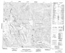
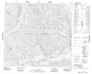
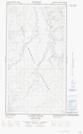
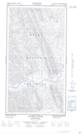
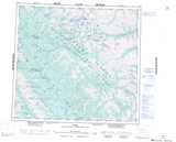
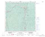
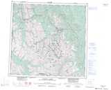
Gathto Creek NTS Map Sheets
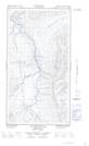
094F15 Mount Lloyd George Topographic Map at 1:50,000 scale
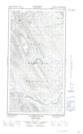
094F16 No Title Topographic Map at 1:50,000 scale
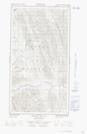
094J04E Gathto Creek Topographic Map at 1:50,000 scale
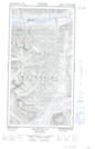
094J04W Gathto Creek Topographic Map at 1:50,000 scale
094J05E Tuchodi River Topographic Map at 1:50,000 scale
094J05W Tuchodi River Topographic Map at 1:50,000 scale
094K01E Mount Sylvia Topographic Map at 1:50,000 scale
094K01W Mount Sylvia Topographic Map at 1:50,000 scale
094F Ware Topographic Map at 1:250,000 scale
094J Fort Nelson Topographic Map at 1:250,000 scale
094K Tuchodi Lakes Topographic Map at 1:250,000 scale