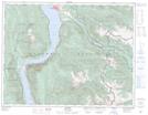
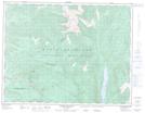
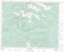
Maps showing Arrowpark Creek, Kootenay Land District, British Columbia
Arrowpark Creek is a River located in Kootenay Land District, British Columbia.
- Latitude: 50° 6' 15'' North (decimal: 50.1041999)
- Longitude: 117° 55' 25'' West (decimal: -117.9235999)
- Topography Feature Category: River
- Geographical Feature: Creek
- Canadian Province/Territory: British Columbia
- Location: Kootenay Land District
- GPS Coordinate Locator Map: Arrowpark Creek Lat/Long
Arrowpark Creek NTS Map Sheets