Ferret Islands Satellite Image Map
Download Free Aerial Photo 003E12 at 1:50,000 scale
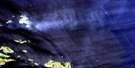
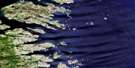
Ferret Islands Satellite Imagery
To view this satellite map, mouse over the air photo on the right.
You can also download this satellite image map for free:
003E12 Ferret Islands high-resolution satellite image map.
Maps for the Ferret Islands aerial map sheet 003E12 at 1:50,000 scale are also available in these versions:
Ferret Islands Surrounding Area Aerial Photo Maps
 |
|||
 |
|||
 |
© Department of Natural Resources Canada. All rights reserved.
Ferret Islands Gazetteer
The following places can be found on satellite image map 003E12 Ferret Islands:
Ferret Islands Satellite Image: Bays
American CoveBack Cove
Farmer Cove
Griffin Harbour
Island Cove
South Shoal Bay
Warren Cove
Ferret Islands Satellite Image: Beaches
Foul BreakersFerret Islands Satellite Image: Capes
Back Cove PointBig Head
Clumpy Point
Fox Head
Indian Head
North Black Head
Salmon Point
Terra Nova Point
Ferret Islands Satellite Image: Channels
Indian TickleFerret Islands Satellite Image: Islands
Deer IslandDuck Island
Ferret Islands
Grappling Island
Grog Island
Harbour Island
Indian Island
Little Duck Island
Little Wolf Island
Lynch Island
North Wolf Island
Parr Island
Pigeon Island
Rodney Island
Round Wolf Island
Rover Island
South Wolf Island
Spotted Island
St. Mary Island
Stag Island
Wedge Island
White Island
Ferret Islands Satellite Image: Shoals
Centipede RockCrab Rock
Dooley Ledge
Farmer Ledge
Fawn Rock
Fawn Rocks
Fish Rock
Gull Battery Rock
Harbour Rock
Mad Moll
Morris Bank
Morris Shoal
New Foundout
North Wolf Rock
Northeast Rock
Ready Rocks
South Wolf Rock
St. Mary Rock
Trusty Rock

© Department of Natural Resources Canada. All rights reserved.
