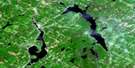
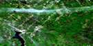
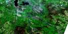
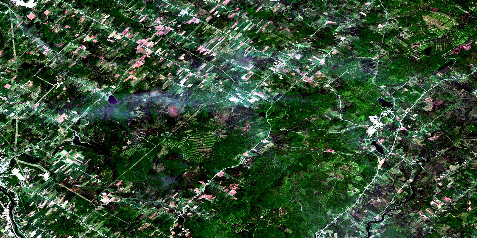
Wotton Satellite Image Map
Download Free Aerial Photo 021E12 at 1:50,000 scale
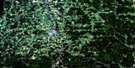
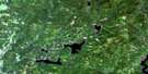
Wotton Satellite Imagery
To view this satellite map, mouse over the air photo on the right.
You can also download this satellite image map for free:
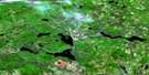
021E12 Wotton high-resolution satellite image map.
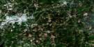
Maps for the Wotton aerial map sheet 021E12 at 1:50,000 scale are also available in these versions:
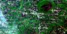
Wotton Surrounding Area Aerial Photo Maps
 |
 |
 |
 |
 |
 |
 |
 |
 |
 |
 |
|
 |
 |
© Department of Natural Resources Canada. All rights reserved.
Wotton Gazetteer
The following places can be found on satellite image map 021E12 Wotton:
Wotton Satellite Image: Bays
Baie BoissonneaultBaie Fredette
Baie Hamel
Baie Larochelle
Baie Lussier
Baie Marchand
Baie Saint-Laurent
Baie St-Laurent
Baie Vigneux
Wotton Satellite Image: Beaches
Plage MarchandPlage P.-E.-Perreault
Wotton Satellite Image: Miscellaneous campsites
Camping FredetteWotton Satellite Image: Capes
La Presqu'îlePointe Marchand
Wotton Satellite Image: City
BromptonvilleFleurimont
Lennoxville
Rock Forest
Sherbrooke
Windsor
Wotton Satellite Image: Falls
Chute à DuplinChutes à Kendall
Chutes Fontainebleau
Wotton Satellite Image: Forests
Bois de Saint-CamilleWotton Satellite Image: Geographical areas
AsbestosBrompton
Bury
Cleveland
Division d'enregistrement de Richmond
Division d'enregistrement de Wolfe
Dudswell
Ham-Sud
Saint-Adolphe-de-Dudswell
Saint-Camille
Saint-Camille
Saint-Claude
Saint-Clément
Saint-Gabriel-Lalemant
Saint-Georges
Saint-Hippolyte
Saint-Philémon
Shipton
Stoke
Weedon
Westbury
Windsor
Wotton Satellite Image: Hydraulic construction
Barrage CharlesBarrage de la Poudrière
Barrage de l'Île
Barrage du Lac-Adolphe
Barrage du Lac-Boissonneault
Barrage Lévesque
Barrage McCarthy
Barrage Watopeka
Écluse Charles
Wotton Satellite Image: Islands
Île BishopÎle Gypsy
Île Rouillard
Îles Coney
Wotton Satellite Image: Lakes
Étang ErleLac à Boisvert
Lac à Gosselin
Lac à Marion
Lac à Victor
Lac Adolphe
Lac Audy
Lac Batley
Lac Beauchêne
Lac Boissonneault
Lac Brabant
Lac chez Piet
Lac Clair
Lac Clear
Lac d'Argent
Lac des Dostie
Lac Dudswell
Lac Fer à Cheval
Lac Miroir
Lac Saint-Adolphe
Lac Saint-Georges
Lac Silver
Lac Stoke
Lac Venner
Lac Watopeka
Lac Welland
Lac Windsor
Lac Windsor
Wotton Satellite Image: Miscellaneous
Centre sportif J.-A.-LemayNotre-Dame-des-Mères
Parc-école Saint-Gabriel
Wotton Satellite Image: Mountains
Butte à MoffatColline Hardwood
Le Dos de Cheval
Mont Chapman
Mont de l'Élan
Montagne d'Adjutor
Montagne du Douze
Monts Stoke
Pic Bald
Pic Chapman
Wotton Satellite Image: Major municipal/district area - major agglomerations
AsbestosLe Val-Saint-François
Les Sources
L'Or-Blanc
Wotton Satellite Image: Conservation areas
Parc Carmen-C.-JuneauParc Carmen-Cloutier-Juneau
Parc des Loisirs
Parc du Caroussel
Parc Jocelyn-Gouin
Parc Raoul-Phaneuf
Parc Watopeka
Wotton Satellite Image: Natural resources sites
Pit à PoudrierPit à Roger
Pit à Venant
Pit à Viau
Wotton Satellite Image: Rivers
Branche AugerBranche Bazin Est
Branche Bourget
Branche Chartier
Branche Hamel
Branche Letendre
Branche Morin
Branche Nault
Branche Picard
Branche Sinotte
Coulée Lapointe-Ruel
Cours d'eau Bourgault
Cours d'eau Bourgeois
Cours d'eau Boutin
Cours d'eau Bruneau
Cours d'eau Champoux
Cours d'eau Cloutier
Cours d'eau Connolly
Cours d'eau Côté
Cours d'eau Drouin
Cours d'eau du Village
Cours d'eau Jacques
Cours d'eau Jean
Cours d'eau Lac Wapelle
Cours d'eau Lachapelle
Cours d'eau Lefebvre-Sévigny
Cours d'eau Letendre
Cours d'eau Mayette
Cours d'eau Pinard
Cours d'eau Soucy
Décharge du Lac d'Argent
Décharge du Lac Miroir
Deuxième embranchement de la Rivière Aulnière
Deuxième Ruisseau
Petit ruisseau Big Hollow
Rivière Danville
Rivière de la Bogue
Rivière Dion
Rivière Madeleine
Rivière Nicolet Centre
Rivière Nicolet Sud
Rivière Nicolet Sud-Ouest
Rivière Saint-François
Rivière Stoke
Rivière Watopeka
Ruisseau à Brochu
Ruisseau à Champoux
Ruisseau à Conrad-Laroche
Ruisseau à la Truite
Ruisseau Auger
Ruisseau Beauchêne
Ruisseau Big Hollow
Ruisseau Bouchard
Ruisseau Brookbury
Ruisseau Bury
Ruisseau Cinquante
Ruisseau Clément
Ruisseau Côté
Ruisseau Côté-Durocher
Ruisseau Côté-Loiselle
Ruisseau Darveau
Ruisseau Dawson
Ruisseau des Labrie
Ruisseau Desruisseaux
Ruisseau Dorman
Ruisseau du Dix
Ruisseau du Huitième Rang
Ruisseau Fontainebleau
Ruisseau Fortier
Ruisseau Frappier
Ruisseau Fréchette
Ruisseau Godbout
Ruisseau Godin
Ruisseau Goupil
Ruisseau Guillemette
Ruisseau Isabel
Ruisseau Jetté
Ruisseau Kingsey
Ruisseau Lacroix
Ruisseau l'Aulnière
Ruisseau Laventure
Ruisseau Leclair
Ruisseau Loiselle
Ruisseau Lussier
Ruisseau Maheu
Ruisseau Mud
Ruisseau Normandin
Ruisseau O'Connolly
Ruisseau Paré
Ruisseau Paré-Lemieux
Ruisseau Péloquin
Ruisseau Pinard
Ruisseau Poudrier
Ruisseau Rowe
Ruisseau Royer
Ruisseau Ryther
Ruisseau Saint-Camille
Ruisseau Saint-Laurent
Ruisseau Saint-Onge
Ruisseau Sam-Orr
Ruisseau Scrosati
Ruisseau Soucy
Ruisseau Têtu
Ruisseau Therrien
Ruisseau Thibodeau
Ruisseau Tomecod
Ruisseau Toutant
Ruisseau Weedon
Ruisseau Willard
Ruisseau Windsor
Wotton Satellite Image: Towns
BishoptonMarbleton
Saint-Georges-de-Windsor
Saint-Grégoire-de-Greenlay
Wottonville
Wotton Satellite Image: Unincorporated areas
BishoptonBishopton
Brookbury
Chevrefils
Domaine-Boutin
Domaine-des-Beaux-Arbres
Domaine-Gagnon
Domaine-Morin
Dudswell-Jonction
Duplin
Erle
Grand-Pré
Hall
Hardwood Hill
Ives
La Poudrière
Lac-Boissonneault
Lac-Stoke
Lime Ridge
Marbleton
Marbleton
Marbleton Station
Mont-Carrier
Notre-Dame-des-Mères
Saint-Adolphe-de-Dudswell
Saint-Adolphe-de-Dudswell
Saint-Camille
Saint-Claude
Saint-Claude-Nord
Saint-Georges-de-Windsor
Saint-Zacharie
Stoke
Stoke
Stoke Centre
Stoke Centre
Stoke-Nord
Titus
Wotton
Wotton Satellite Image: Low vegetation
La BogueWotton Satellite Image: Villages
AscotAscot Corner
Brompton
Bury
Deauville
Dudswell
Dudswell
Saint-Camille
Saint-Claude
Saint-Élie-d'Orford
Saint-François-Xavier-de-Brompton
Saint-Georges-de-Windsor
Saint-Georges-de-Windsor
Saint-Joseph-de-Ham-Sud
Shipton
Stoke
Stoke
Val-Joli
Westbury
Windsor
Wotton
Wotton
© Department of Natural Resources Canada. All rights reserved.
