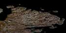
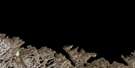
Pointe Jean-Talon Satellite Image Map
Download Free Aerial Photo 025E01 at 1:50,000 scale
Pointe Jean-Talon Satellite Imagery
To view this satellite map, mouse over the air photo on the right.
You can also download this satellite image map for free:
025E01 Pointe Jean-Talon high-resolution satellite image map.
Maps for the Pointe Jean-Talon aerial map sheet 025E01 at 1:50,000 scale are also available in these versions:
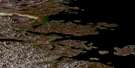
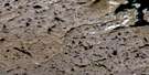
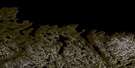
Pointe Jean-Talon Surrounding Area Aerial Photo Maps
 |
|||
 |
|||
 |
 |
 |
 |
© Department of Natural Resources Canada. All rights reserved.
Pointe Jean-Talon Gazetteer
The following places can be found on satellite image map 025E01 Pointe Jean-Talon:
Pointe Jean-Talon Satellite Image: Bays
Anse Iqiup ImangaAnse Nuvuttuq
Baie Diana
Baie Héricart
Baie Héricart
Baie Tuvak
Diana Bay
Ekkik Cove
Tuvak Bay
Pointe Jean-Talon Satellite Image: Capes
Pointe CourcellesPointe d'Argenson
Pointe D'Argenson
Pointe d'Avaugour
Pointe D'Avaugour
Pointe de Mézy
Pointe De Mézy
Pointe Duchesnau
Pointe Fuvak
Pointe Hocquart
Pointe Jean-Talon
Pointe Strangulation
Pointe Tuvak
Tulugak Point
Pointe Jean-Talon Satellite Image: Channels
Détroit d'HudsonHudson Strait
Pointe Jean-Talon Satellite Image: Cliffs
Falaise QutairquqPointe Jean-Talon Satellite Image: Islands
Diana IslandFord Island
Imnak Island
Kingnektak Island
Smooth Island
Pointe Jean-Talon Satellite Image: Shoals
Daryl Rock
© Department of Natural Resources Canada. All rights reserved.
