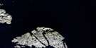
Lower Savage Islands Satellite Image Map
Download Free Aerial Photo 025H13 at 1:50,000 scale
Lower Savage Islands Satellite Imagery
To view this satellite map, mouse over the air photo on the right.
You can also download this satellite image map for free:
025H13 Lower Savage Islands high-resolution satellite image map.
Maps for the Lower Savage Islands aerial map sheet 025H13 at 1:50,000 scale are also available in these versions:
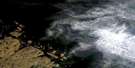
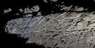
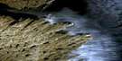
Lower Savage Islands Surrounding Area Aerial Photo Maps
 |
 |
 |
|
 |
 |
||
 |
 |
||
© Department of Natural Resources Canada. All rights reserved.
Lower Savage Islands Gazetteer
The following places can be found on satellite image map 025H13 Lower Savage Islands:
Lower Savage Islands Satellite Image: Bays
Frobisher BaySavage Harbour
Lower Savage Islands Satellite Image: Capes
Meta Incognita PeninsulaPoint Meridian
Lower Savage Islands Satellite Image: Channels
Annapolis StraitDétroit d'Hudson
Gabriel Strait
Hudson Strait
Lower Savage Islands Satellite Image: Islands
Lower Savage IslandsLower Savage Islands Satellite Image: Mountains
East Bluff
© Department of Natural Resources Canada. All rights reserved.
