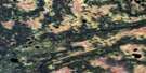
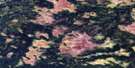
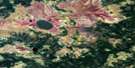
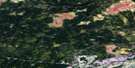
Limestone Rapids Satellite Image Map
Download Free Aerial Photo 042K01 at 1:50,000 scale
Limestone Rapids Satellite Imagery
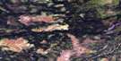
To view this satellite map, mouse over the air photo on the right.
You can also download this satellite image map for free:
042K01 Limestone Rapids high-resolution satellite image map.
Maps for the Limestone Rapids aerial map sheet 042K01 at 1:50,000 scale are also available in these versions:
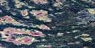
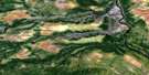
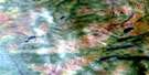
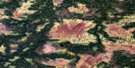
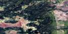
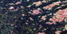
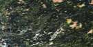
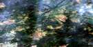
Limestone Rapids Surrounding Area Aerial Photo Maps
 |
 |
 |
 |
 |
 |
 |
 |
 |
 |
 |
 |
 |
 |
 |
 |
© Department of Natural Resources Canada. All rights reserved.
Limestone Rapids Gazetteer
The following places can be found on satellite image map 042K01 Limestone Rapids:
Limestone Rapids Satellite Image: Lakes
Bittern LakeBluejay Lake
Blue-winged Teal Lake
Canvasback Lake
Cardinal Lake
Coot Lake
Crane Lake
Gadwall Lake
Goldeneye Lake
Grebe Lake
Green-winged Teal Lake
Killdeer Lake
Loon Lake
Oldsquaw Lake
Pintail Lake
Rail Lake
Redhead Lake
Robin Lake
Scaup Lake
Seagull Lake
Tanager Lake
Wren Lake
Limestone Rapids Satellite Image: Rapids
Limestone RapidsLimestone Rapids Satellite Image: Rivers
Fox RiverKabinakagami River
Nagagami River
Otasawian River
Pisikaniwi River
Pitopiko River
Rogers Creek
Rowlandson Creek
Squirrel River
West Pitopiko River

© Department of Natural Resources Canada. All rights reserved.
042K Related Maps:
042K Kenogami River042K01 Limestone Rapids
042K02 Feagan Lake
042K03 Pagwa River
042K04 Atikasibi River
042K05 Legarde River
042K06 Jog Lake
042K07 Little Ash River
042K08 Mammamattawa
042K09 Pitukupi Lake
042K10 Kingfisher River
042K11 Little Drowning Lake
042K12 Furry Lake
042K13 Barber Lake
042K14 Britt Creek
042K15 Little Drowning River
042K16 Wakashi River
