Wollaston Islands Satellite Image Map
Download Free Aerial Photo 048D09 at 1:50,000 scale
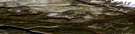
Wollaston Islands Satellite Imagery
To view this satellite map, mouse over the air photo on the right.
You can also download this satellite image map for free:
048D09 Wollaston Islands high-resolution satellite image map.
Maps for the Wollaston Islands aerial map sheet 048D09 at 1:50,000 scale are also available in these versions:
Wollaston Islands Surrounding Area Aerial Photo Maps
 |
 |
 |
 |
 |
 |
 |
 |
 |
 |
 |
 |
© Department of Natural Resources Canada. All rights reserved.
Wollaston Islands Gazetteer
The following places can be found on satellite image map 048D09 Wollaston Islands:
Wollaston Islands Satellite Image: Bays
Baie de BaffinNavy Board Inlet
Tay Bay
Wollaston Islands Satellite Image: Capes
Cape HayWollaston Islands Satellite Image: Channels
Lancaster SoundParry Channel
Wollaston Islands Satellite Image: Glaciers
Inussualuk GlacierWollaston Islands Satellite Image: Islands
Bylot IslandWollaston Islands
Wollaston Islands Satellite Image: Mountains
Byam Martin MountainsWollaston Islands Satellite Image: Conservation areas
Bylot Island Bird SanctuaryRefuge d'oiseaux de l'Île Bylot

© Department of Natural Resources Canada. All rights reserved.
