Rainy River Satellite Image Map
Download Free Aerial Photo 052D15 at 1:50,000 scale
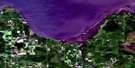
Rainy River Satellite Imagery
To view this satellite map, mouse over the air photo on the right.
You can also download this satellite image map for free:
052D15 Rainy River high-resolution satellite image map.
Maps for the Rainy River aerial map sheet 052D15 at 1:50,000 scale are also available in these versions:
Rainy River Surrounding Area Aerial Photo Maps
 |
 |
||
 |
|||
© Department of Natural Resources Canada. All rights reserved.
Rainy River Gazetteer
The following places can be found on satellite image map 052D15 Rainy River:
Rainy River Satellite Image: Bays
Big Traverse BayWindy Bay
Rainy River Satellite Image: Beaches
Budreau's BeachRainy River Satellite Image: Capes
Rocky PointWindy Point
Rainy River Satellite Image: Channels
Inside ChannelRainy River Satellite Image: Geographical areas
Rainy RiverSpohn
Rainy River Satellite Image: Indian Reserves
Réserve indienne Wild Lands 15MWild Lands 15M
Wild Lands Indian Reserve 15M
Rainy River Satellite Image: Islands
Burton IslandQuick Island
Sable Islands
Snake Island
Rainy River Satellite Image: Lakes
Lac des BoisLake of the Woods
Mud Lake
Rainy River Satellite Image: Other municipal/district area - miscellaneous
AtwoodBlue
Dawson
Dilke
Worthington
Rainy River Satellite Image: Conservation areas
Agassiz Peatlands Provincial Nature ReserveAgassiz Peatlands Provincial Park
Lake of the Woods Waters Conservation Reserve
Sable Islands Nature Reserve
Sable Islands Provincial Nature Reserve
Rainy River Satellite Image: Rivers
McGinnis CreekMcInnis Creek
Rainy River
Rivière à la Pluie
Wilson Creek
Rainy River Satellite Image: Shoals
Burton ReefCoutts Reef
Windy Point Reef
Rainy River Satellite Image: Unincorporated areas
Harris HillMcGinnis Creek
McInnis Creek

© Department of Natural Resources Canada. All rights reserved.
