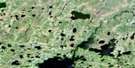
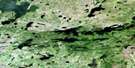
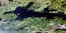
Edmund Lake Satellite Image Map
Download Free Aerial Photo 053K11 at 1:50,000 scale
Edmund Lake Satellite Imagery
To view this satellite map, mouse over the air photo on the right.
You can also download this satellite image map for free:
053K11 Edmund Lake high-resolution satellite image map.
Maps for the Edmund Lake aerial map sheet 053K11 at 1:50,000 scale are also available in these versions:
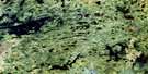
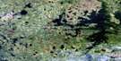
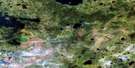
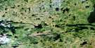
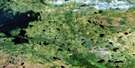
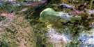
Edmund Lake Surrounding Area Aerial Photo Maps
 |
 |
 |
 |
 |
 |
 |
 |
 |
 |
 |
 |
 |
 |
 |
 |
© Department of Natural Resources Canada. All rights reserved.
Edmund Lake Gazetteer
The following places can be found on satellite image map 053K11 Edmund Lake:
Edmund Lake Satellite Image: Bays
Kitchisakik BayTodd Bay
Wapawaka Bay
Wilkinson Bay
Edmund Lake Satellite Image: Islands
Bateman IslandBuckley Island
Fred Brown Island
Gordon Brown Island
Madden Island
Marks Island
Edmund Lake Satellite Image: Lakes
Aiken LakeAllan Parker Lake
Blackford Lake
Buchanan Lake
David Clark Lake
Dorral Lake
Dorval Lake
Edmund Lake
Gile Lake
John Aitken Lake
Kapaykwakamokatik Lake
Kwaskwaypichikawan Lake
Le Maistre Lake
Margaret Lake
Mistatikamik Lake
Modeen Lake
Okas Lake
Rothery Lake
Rothesay Lake
Trenter Lake
Trentner Lake
Wapapiskwatayo Lake
Wapikapow Lake
Edmund Lake Satellite Image: Rivers
Atim RiverKanusasu River
Micheekun River
Mistatikamik River
Okas Creek
Red Sucker River
Sakik Creek
Wapawaka River
Edmund Lake Satellite Image: Unincorporated areas
KitchisakikMatawak
© Department of Natural Resources Canada. All rights reserved.
053K Related Maps:
053K Stull Lake053K01 Little Sachigo Lake
053K02 Pierce Lake
053K03 Robson Lake
053K04 Red Sucker Lake
053K05 Sharpe Lake
053K06 Makataysip Lake
053K07 Stull Lake
053K08 Rapson Bay
053K09 Ney Lake
053K10 Kistigan Lake
053K11 Edmund Lake
053K12 Pesanapisko Lake
053K13 Yellowback Island
053K14 Kenyon Lake
053K15 Atikamaykus Lake
053K16 Umisko Lake
