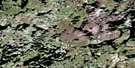
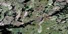
Booth Lake Satellite Image Map
Download Free Aerial Photo 064O05 at 1:50,000 scale
Booth Lake Satellite Imagery
To view this satellite map, mouse over the air photo on the right.
You can also download this satellite image map for free:
064O05 Booth Lake high-resolution satellite image map.
Maps for the Booth Lake aerial map sheet 064O05 at 1:50,000 scale are also available in these versions:
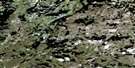
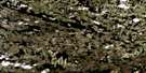
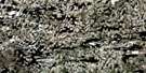
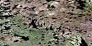
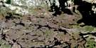
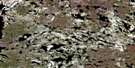
Booth Lake Surrounding Area Aerial Photo Maps
 |
 |
 |
 |
 |
 |
 |
 |
 |
 |
 |
 |
 |
 |
 |
 |
© Department of Natural Resources Canada. All rights reserved.
Booth Lake Gazetteer
The following places can be found on satellite image map 064O05 Booth Lake:
Booth Lake Satellite Image: Bays
Hamilton BayHughes Bay
Little Bay
Watson Bay
Booth Lake Satellite Image: Capes
English PointBooth Lake Satellite Image: Islands
Bignell IslandCowie Island
Genaille Island
Girouard Island
Park Island
Williamson Island
Booth Lake Satellite Image: Lakes
Alyward LakeAlyward Lake
Atimkameskak Lake
Bernath Lake
Billing Lake
Booth Lake
De Lipper Lake
Delipper Lake
Hoagg Lake
Jobin Lake
Kitteringham Lake
Kuzenko Lake
Lechowicz Lake
Makarsky Lake
Misztur Lake
Rudkawich Lake
Schofield Lake
Shannon Lake
Shumyhora Lake
Slyzuk Lake
Toon Lake
Tracy Williams Lake
Trohubiak Lake
Zubriski Lake
Booth Lake Satellite Image: Mountains
Paterson HillRobertson Esker
Booth Lake Satellite Image: Rivers
Seman River
© Department of Natural Resources Canada. All rights reserved.
064O Related Maps:
064O Munroe Lake064O01 Adair Lake
064O02 Schacht Lake
064O03 Canfield Lake
064O04 Doig Lake
064O05 Booth Lake
064O06 Calder Lake
064O07 Sandhill Lake
064O08 Baird Lake
064O09 Croll Lake
064O10 Askey Lake
064O11 Corbett Lake
064O12 Drake Lake
064O13 Todd Island
064O14 Lowry Lake
064O15 Blevins Lake
064O16 Hutton Lake
