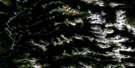
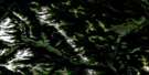
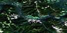
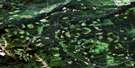
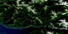
Butler Ridge Satellite Image Map
Download Free Aerial Photo 094B01 at 1:50,000 scale
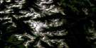
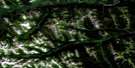
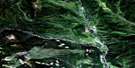
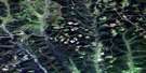
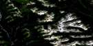
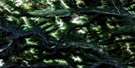
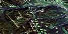
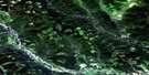
Butler Ridge Satellite Imagery
To view this satellite map, mouse over the air photo on the right.
You can also download this satellite image map for free:
094B01 Butler Ridge high-resolution satellite image map.
Maps for the Butler Ridge aerial map sheet 094B01 at 1:50,000 scale are also available in these versions:
Butler Ridge Surrounding Area Aerial Photo Maps
 |
 |
 |
 |
 |
 |
 |
 |
 |
 |
 |
 |
 |
 |
 |
 |
© Department of Natural Resources Canada. All rights reserved.
Butler Ridge Gazetteer
The following places can be found on satellite image map 094B01 Butler Ridge:
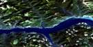
Butler Ridge Satellite Image: District municipality
Hudson's HopeButler Ridge Satellite Image: Geographical areas
Peace River Land DistrictButler Ridge Satellite Image: Hydraulic construction
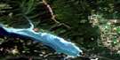
W.A.C. Bennett DamButler Ridge Satellite Image: Lakes
Chinaman LakeChunamun Lake
Dinosaur Lake
Dunlevy Lake
Wapoose Lake
Williston Lake
Butler Ridge Satellite Image: Mountains
Bullhead MountainButler Ridge
Mount Gething
Portage Mountain
Rocky Mountain Foothills
Butler Ridge Satellite Image: Major municipal/district area - major agglomerations
Peace River Regional DistrictButler Ridge Satellite Image: Conservation areas
Butler Ridge ParkDunlevy Recreation Area
Butler Ridge Satellite Image: Rivers
Beany CreekBrenot Creek
Carey Creek
Cust Creek
Danish Creek
Dowling Creek
Dresser Creek
Dunlevy Creek
Elizabeth Creek
Farrell Creek
Gaylard Creek
Gething Creek
Gravel Hill Creek
Lynx Creek
Mackie Creek
Peace River
Portage Creek
Rivière de la Paix
Ruddy Creek
Stott Creek
Table Creek
Track Creek
Wapoose Creek
Butler Ridge Satellite Image: River features
Peace ReachButler Ridge Satellite Image: Road features
Rocky Mountain PortageButler Ridge Satellite Image: Unincorporated areas
Beattie LandingBeryl Prairie
Cust
Gething
Portage Mountain
Butler Ridge Satellite Image: Low vegetation
Beryl Prairie
© Department of Natural Resources Canada. All rights reserved.
094B Related Maps:
094B Halfway River094B01 Butler Ridge
094B02 Jones Peak
094B03 Mount Brewster
094B04 Wicked River
094B05 Gauvreau Creek
094B06 Emerslund Lakes
094B07 Hackney Hills
094B08 Kobes Creek
094B09 Aikman Creek
094B10 Chowade River
094B11 Christina Falls
094B12 Mount Lady Laurier
094B13 Mount Robb
094B14 Mount Laurier
094B15 Cypress Creek
094B16 Blair Creek
