Cape Cam Satellite Image Map
Download Free Aerial Photo 098H16 at 1:50,000 scale
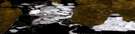
Cape Cam Satellite Imagery
To view this satellite map, mouse over the air photo on the right.
You can also download this satellite image map for free:
098H16 Cape Cam high-resolution satellite image map.
Maps for the Cape Cam aerial map sheet 098H16 at 1:50,000 scale are also available in these versions:
Cape Cam Surrounding Area Aerial Photo Maps
 |
|||
© Department of Natural Resources Canada. All rights reserved.
Cape Cam Gazetteer
The following places can be found on satellite image map 098H16 Cape Cam:
Cape Cam Satellite Image: Bays
Butter BayWalker Inlet
Wolley Bay
Cape Cam Satellite Image: Capes
Cape CamCape Cam Satellite Image: Channels
Crozier ChannelM'Clure Strait
Parry Channel
Cape Cam Satellite Image: Islands
Îles de la Reine-ÉlisabethParry Islands
Prince Patrick Island
Queen Elizabeth Islands
Cape Cam Satellite Image: Mountains
Hardinge MountainsCape Cam Satellite Image: Territory
Northwest TerritoriesTerritoires du Nord-Ouest

© Department of Natural Resources Canada. All rights reserved.
