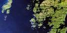
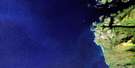
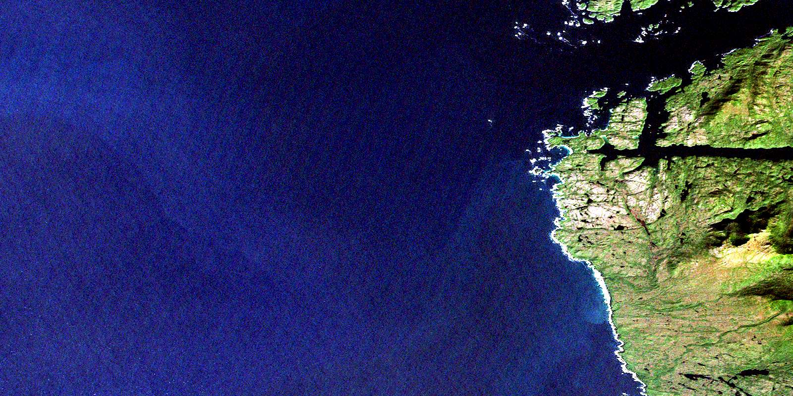
Calvert Island Satellite Image Map
Download Free Aerial Photo 102P09 at 1:50,000 scale
Calvert Island Satellite Imagery
To view this satellite map, mouse over the air photo on the right.
You can also download this satellite image map for free:
102P09 Calvert Island high-resolution satellite image map.
Maps for the Calvert Island aerial map sheet 102P09 at 1:50,000 scale are also available in these versions:
Calvert Island Surrounding Area Aerial Photo Maps
 |
|||
 |
|||
 |
|||
© Department of Natural Resources Canada. All rights reserved.
Calvert Island Gazetteer
The following places can be found on satellite image map 102P09 Calvert Island:
Calvert Island Satellite Image: Bays
Adams HarbourBolivar Islet
Goldstream Harbour
Keith Anchorage
Pruth Bay
Queen Charlotte Sound
Calvert Island Satellite Image: Capes
Barney PointDublin Point
Hawser Point
Odlum Point
Sandspit Point
Whittaker Point
Calvert Island Satellite Image: Channels
Choked PassageHakai Passage
Kwakshua Channel
Calvert Island Satellite Image: Islands
Boas IsletBreaker Group
Calvert Island
Donald Island
Flat Islands
Hecate Island
Jupiter Island
Leading Island
Lower Island
Lower Islands
Mars Islet
Meay Islet
Mercury Islet
Odlum Island
Planet Group
Rattenbury Island
Starfish Island
Stirling Island
Surf Islands
Calvert Island Satellite Image: Lakes
Chic Chic LakeCalvert Island Satellite Image: Mountains
Stony SaddleCalvert Island Satellite Image: Major municipal/district area - major agglomerations
Central Coast Regional DistrictCalvert Island Satellite Image: Conservation areas
Hakai Recreation AreaCalvert Island Satellite Image: Rivers
Big Spring CreekCalvert Island Satellite Image: Shoals
Breaker LedgeCarrington Reef
Codfish Rock
Evening Rock
Fairway Rock
Fitz Roy Reef
Foster Rocks
Mainguy Rock
North Pointers Rocks
Port Reef
South Pointers Rocks
Starfish Ledge
© Department of Natural Resources Canada. All rights reserved.
