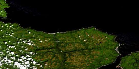
Jalun River Satellite Imagery
To view this satellite map, mouse over the air photo on the right.
You can also download this satellite image map for free:
103K02 Jalun River high-resolution satellite image map.
Maps for the Jalun River aerial map sheet 103K02 at 1:50,000 scale are also available in these versions:
Jalun River Surrounding Area Aerial Photo Maps
© Department of Natural Resources Canada. All rights reserved.
Jalun River Gazetteer
The following places can be found on satellite image map 103K02 Jalun River:
Jalun River Satellite Image: Bays
Beal CoveBruin Bay
Craft Bay
Dibrell Bay
Egeria Bay
Explorer Bay
Hanna Bay
Henslung Cove
Hussan Bay
Naden Harbour
Pillar Bay
Jalun River Satellite Image: Beaches
The BarJalun River Satellite Image: Capes
Andrews PointBain Point
Cape Naden
Cohoe Point
Deep Water Point
Deepwater Point
George Point
Gunia Point
Holland Point
Inskip Point
Isabella Point
Jorey Point
Klashwun Point
Mary Point
McPherson Point
Nankivell Point
Seath Point
Village Point
Jalun River Satellite Image: Channels
Alexandra NarrowsDixon Entrance
Hodgson Passage
Parry Passage
Smyth Passage
Solide Passage
Virago Sound
Jalun River Satellite Image: Indian Reserves
Cohoe Point Indian Reserve 20Daningay Indian Reserve 12
Egeria Bay Indian Reserve 19
Jalun Indian Reserve 14
Kung Indian Reserve 11
Réserve indienne Cohoe Point 20
Réserve indienne Daningay 12
Réserve indienne Egeria Bay 19
Réserve indienne Jalun 14
Réserve indienne Kung 11
Réserve indienne Tatense 16
Réserve indienne Yatze 13
Tatense Indian Reserve 16
Yatze Indian Reserve 13
Jalun River Satellite Image: Islands
Graham IslandLangara Island
Lucy Island
Mazarredo Islands
Queen Charlotte Islands
Jalun River Satellite Image: Mountains
Mount PivotPivot Mountain
Jalun River Satellite Image: Rivers
Beresford CreekGermania Creek
Jalun River
Sialun Creek
Jalun River Satellite Image: Shoals
Alert RockConeehaw Rock
Douglas Rock
Hastings Reef
Haswell Reef
Observatory Rock
Pillar Rock
Richard III Bank
Shag Rock
Testlatlints Rock
Jalun River Satellite Image: Unincorporated areas
DadensKung
Naden Harbour
© Department of Natural Resources Canada. All rights reserved.


