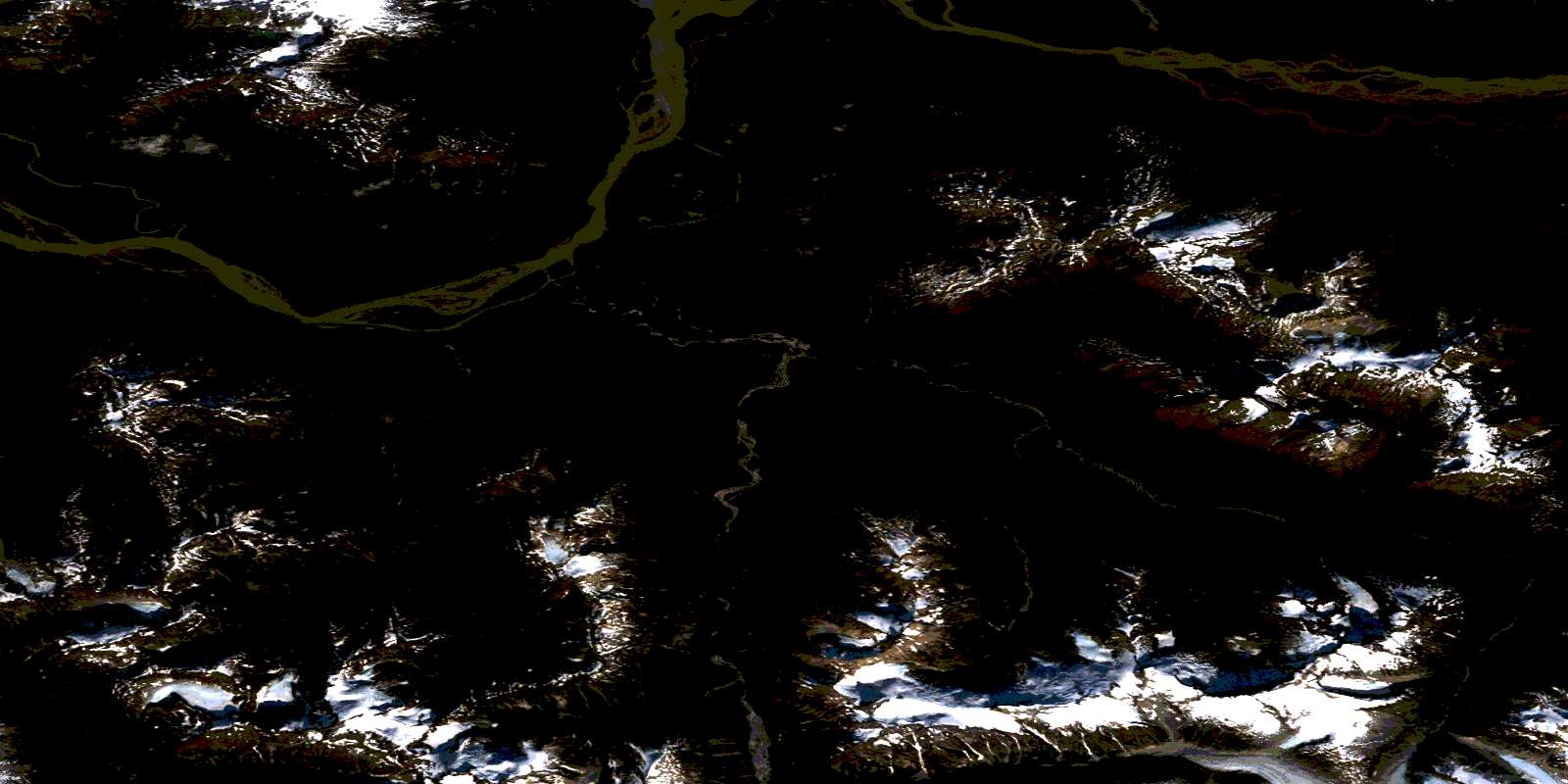
Katete River Satellite Image Map
Download Free Aerial Photo 104B12 at 1:50,000 scale
Katete River Satellite Imagery
To view this satellite map, mouse over the air photo on the right.
You can also download this satellite image map for free:
104B12 Katete River high-resolution satellite image map.
Maps for the Katete River aerial map sheet 104B12 at 1:50,000 scale are also available in these versions:
Katete River Surrounding Area Aerial Photo Maps
 |
 |
 |
 |
 |
 |
 |
 |
 |
 |
 |
|
 |
© Department of Natural Resources Canada. All rights reserved.
Katete River Gazetteer
The following places can be found on satellite image map 104B12 Katete River:
Katete River Satellite Image: Lakes
Kakati LakeLake Kakati
Katete River Satellite Image: Mountains
Boundary RangesCoast Mountains
Elbow Mountain
Iskut Mountain
Kahtate Mountain
Katete Mountain
Mount Cote
Mount Geoffrion
Mount Whipple
Snowy Mountain
Katete River Satellite Image: Major municipal/district area - major agglomerations
Regional District of Kitimat-StikineKatete River Satellite Image: Rivers
Caralin CreekGeoffrion Creek
Inhini River
Iskut River
Johnson River
Kahtate River
Katete River
Stikine River
Tasakili River
Whipple Creek
Katete River Satellite Image: Unincorporated areas
BoundaryStikine
© Department of Natural Resources Canada. All rights reserved.
104B Related Maps:
104B Iskut River104B01 Leduc Glacier
104B06 Mt Lewis Cass
104B07 Unuk River
104B08 Frank Mackie Glacier
104B09 John Peaks
104B10 Snippaker Creek
104B11 Craig River
104B12 Katete River
104B13 Great Glacier
104B14 Hoodoo Mountain
104B15 Forrest Kerr Creek
104B16E Bob Quinn Lake
104B16W Bob Quinn Lake
