Bray Hill Topo Map Online
Download Free Topo Map Sheet 025C08 at 1:50,000 scale
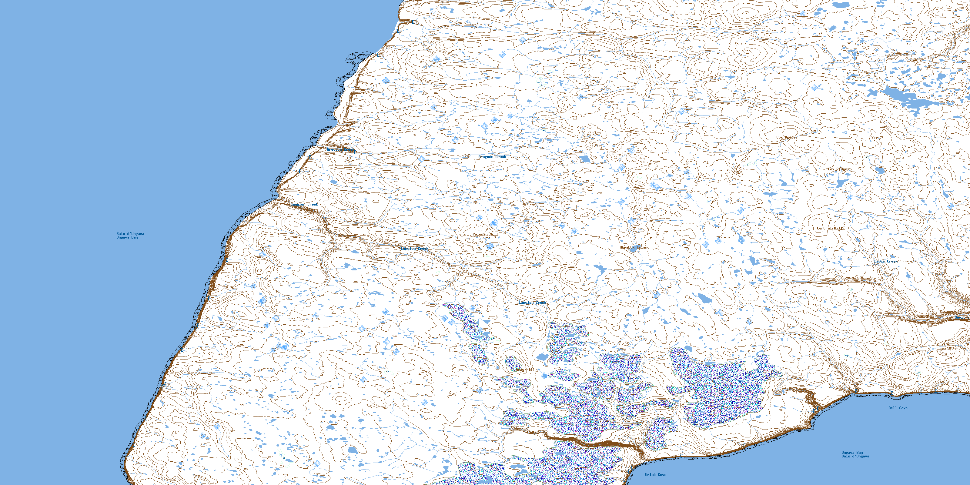
025C08 Bray Hill Topo Map
To view this map, mouse over the map preview on the right.
You can also download this topo map for free:
025C08 Bray Hill high-resolution topo map image.
Maps for the Bray Hill topo map sheet 025C08 at 1:50,000 scale are also available in these versions:
Bray Hill Surrounding Area Topo Maps
 |
 |
||
 |
 |
||
 |
 |
||
 |
 |
© Department of Natural Resources Canada. All rights reserved.
Bray Hill Gazetteer
The following places can be found on topographic map sheet 025C08 Bray Hill:
Bray Hill Topo Map: Bays
Bell CoveUmiak Cove
Bray Hill Topo Map: Islands
Akpatok IslandBray Hill Topo Map: Mountains
Bray HillCentral Hill
Cox Ridges
Polunin Hill
Bray Hill Topo Map: Rivers
Davis CreekGregson Creek
Langley Creek
© Department of Natural Resources Canada. All rights reserved.
