Digges Harbour Topo Map Online
Download Free Topo Map Sheet 035K12 at 1:50,000 scale
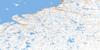
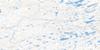
035K12 Digges Harbour Topo Map
To view this map, mouse over the map preview on the right.
You can also download this topo map for free:
035K12 Digges Harbour high-resolution topo map image.
Maps for the Digges Harbour topo map sheet 035K12 at 1:50,000 scale are also available in these versions:
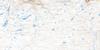
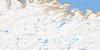
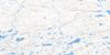
Digges Harbour Surrounding Area Topo Maps
 |
 |
 |
|
 |
 |
 |
 |
 |
 |
 |
 |
© Department of Natural Resources Canada. All rights reserved.
Digges Harbour Gazetteer
The following places can be found on topographic map sheet 035K12 Digges Harbour:
Digges Harbour Topo Map: Bays
Anse AppaluitDigges Harbour
Digges Harbour Topo Map: Capes
Cap Saint-LouisCap Siukkaaluk
Cap Wolstenholme
Cape Digges
Pointe du Soleil-d'Afrique
Pointe Isussijuaq
Digges Harbour Topo Map: Channels
Détroit d'HudsonPasse Digges
Digges Harbour Topo Map: Cliffs
Falaise KinginnijuaqDigges Harbour Topo Map: Islands
Digges IslandDigges Islands
Dome Islet
Digges Harbour Topo Map: Mountains
Colline UummanaqDigges Harbour Topo Map: Rivers
Rivière Nauyok
© Department of Natural Resources Canada. All rights reserved.
