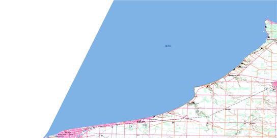
040O01 Brights Grove Topo Map
To view this map, mouse over the map preview on the right.
You can also download this topo map for free:
040O01 Brights Grove high-resolution topo map image.
Maps for the Brights Grove topo map sheet 040O01 at 1:50,000 scale are also available in these versions:
Brights Grove Surrounding Area Topo Maps
© Department of Natural Resources Canada. All rights reserved.
Brights Grove Gazetteer
The following places can be found on topographic map sheet 040O01 Brights Grove:
Brights Grove Topo Map: Beaches
Ipperwash BeachBrights Grove Topo Map: Capes
Blue PointCape Ipperwash
Cedar Point
Harris Point
Kettle Point
Point Edward
Brights Grove Topo Map: City
Lambton ShoresSarnia
Sarnia-Clearwater
Brights Grove Topo Map: Geographical areas
BosanquetLambton
Plympton
Sarnia
Warwick
Brights Grove Topo Map: Hydraulic construction
Cull DrainWawanosh Drain
Brights Grove Topo Map: Indian Reserves
Kettle Point 44Kettle Point Indian Reserve 44
Réserve indienne Kettle Point 44
Brights Grove Topo Map: Lakes
Lac HuronLake Chipican
Lake Huron
Brights Grove Topo Map: Major municipal/district area - major agglomerations
LambtonBrights Grove Topo Map: Other municipal/district area - miscellaneous
PlymptonPlympton
Warwick
Warwick
Brights Grove Topo Map: Provinces
OntarioBrights Grove Topo Map: Rivers
Aberarder CreekBonnie Doon Creek
Cow Creek
Errol Creek
Hickory Creek
Highland Creek
Perch Creek
Perch Creek
Pulse Creek
Rivière Sainte-Claire
Shashawandah Creek
St. Clair River
Brights Grove Topo Map: Shoals
Corsica ShoalHarlem Shoal
Kettle Point Reef
Brights Grove Topo Map: Towns
BosanquetClearwater
Plympton-Wyoming
Brights Grove Topo Map: Unincorporated areas
AberarderBlackwell
Brights Grove
Camlachie
Cedar Point
Errol
Eton Court
Forest
Forest Hill
Glendale Beach
Gustin Grove
Highland Glen
Hillsborough Beach
Huron Heights
Ipperwash Beach
Kennedy Acres
Kettle Point
Miller
Oak Acres
Oakwood Corners
Perch
Uttoxeter
Valleyfield
Vyner
Wees Beach
Woodland
Woodrow Beach
Woodrowe Shores
Brights Grove Topo Map: Villages
Point Edward© Department of Natural Resources Canada. All rights reserved.


