Gothe Island Topo Map Online
Download Free Topo Map Sheet 065D08 at 1:50,000 scale
065D08 Gothe Island Topo Map
To view this map, mouse over the map preview on the right.
You can also download this topo map for free:
065D08 Gothe Island high-resolution topo map image.
Maps for the Gothe Island topo map sheet 065D08 at 1:50,000 scale are also available in these versions:
Gothe Island Surrounding Area Topo Maps
 |
 |
 |
 |
 |
 |
 |
 |
 |
 |
 |
 |
 |
 |
 |
 |
© Department of Natural Resources Canada. All rights reserved.
Gothe Island Gazetteer
The following places can be found on topographic map sheet 065D08 Gothe Island:
Gothe Island Topo Map: Islands
Gothe IslandKai Island
Gothe Island Topo Map: Lakes
Kasba Lake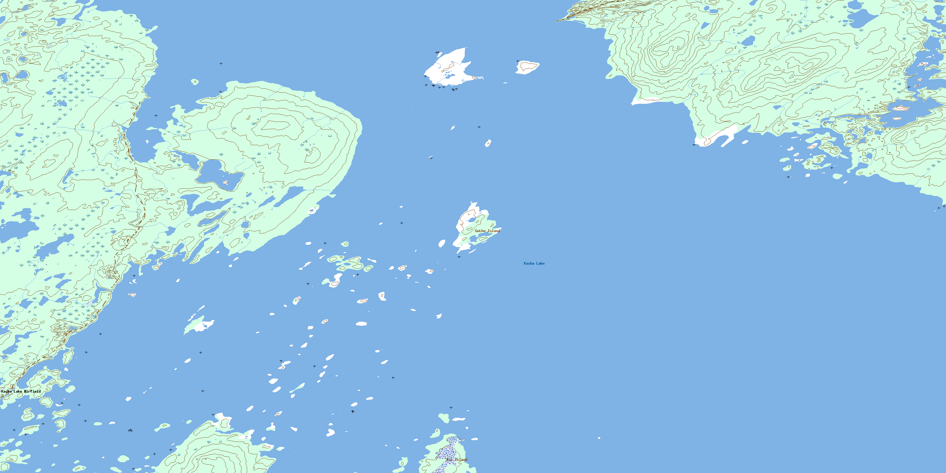
© Department of Natural Resources Canada. All rights reserved.
065D Related Maps:
065D Snowbird Lake065D01 White Partridge Island
065D02 Klokol Lake
065D03 Deering Island
065D04 Striding River
065D05 Meyrick Lake
065D06 Dehoux Bay
065D07 Barr Lake
065D08 Gothe Island
065D09 Simons Island
065D10 Latimer Lake
065D11 Suggitt
065D12 Lone Lake
065D13 Allen Lake
065D14 Sherwood Lake
065D15 Kakoot Lake
065D16 Linklater Lake
