Climax Topo Map Online
Download Free Topo Map Sheet 072F01 at 1:50,000 scale
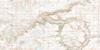
072F01 Climax Topo Map
To view this map, mouse over the map preview on the right.
You can also download this topo map for free:
072F01 Climax high-resolution topo map image.
Maps for the Climax topo map sheet 072F01 at 1:50,000 scale are also available in these versions:
Climax Surrounding Area Topo Maps
 |
 |
 |
 |
 |
 |
 |
 |
 |
 |
 |
 |
 |
 |
 |
 |
© Department of Natural Resources Canada. All rights reserved.
Climax Gazetteer
The following places can be found on topographic map sheet 072F01 Climax:
Climax Topo Map: Lakes
Island LakeLonetree Lake
Climax Topo Map: Other municipal/district area - miscellaneous
Frontier No. 19Lone Tree No. 18
Val Marie No. 17
Climax Topo Map: Rivers
Whitewater CreekClimax Topo Map: Unincorporated areas
CanuckTreelon
Climax Topo Map: Valleys
Cottonwood CouleeClimax Topo Map: Villages
BrackenClimax
© Department of Natural Resources Canada. All rights reserved.
072F Related Maps:
072F Cypress Lake072F01 Climax
072F02 Frontier
072F03 Lyons Creek
072F04 Willow Creek
072F05 Consul
072F06 Ravenscrag
072F07 Eastbrook Coulee
072F08 Badland Lake
072F09 Shaunavon
072F10 Dollard
072F11 Fairwell Creek
072F12 Hungerford Lakes
072F13 Kincorth
072F14 Maple Creek
072F15 Skull Creek
072F16 Simmie
